Höpfingen geodata
Höpfingen (Baden-Württemberg) is a seat of a fourth-order administrative division; located in Germany in Europe/Berlin (GMT+2) time zone. With population of 3,331 people, there are 3735 cities with bigger population in this country. Compared to other cities in Germany, 73.7% of cities are located further ↑North; 58.9% of cities are located further →East and 73.1% of cities have lower elevation than Höpfingen. Note1
Administrative division(s):
- Level 1: Baden-Württemberg
- Level 2: Karlsruhe Region
- Level 3: Neckar-Odenwald-Kreis
- Level 4: Höpfingen


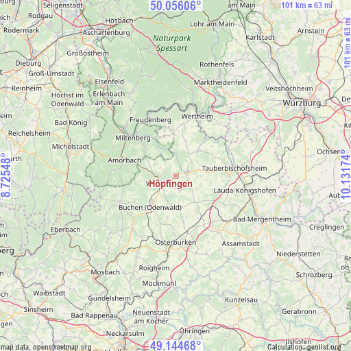
Höpfingen GPS coordinates[2]
49° 36' 9" North, 9° 25' 42.996" East
| Map corner | latitude | longitude |
|---|---|---|
| Upper-left | 50.05606°, | 8.72548° |
| Center: | 49.6025°, | 9.42861° |
| Lower-right: | 49.14468°, | 10.13174° |
| Map W x H: | 101.3×101.3 km | = 62.9×62.9mi |
| max Lat: | 55.01917° ⇑73.7% North |
| Höpfingen: | 49.6025° |
| min Lat: | ⇓26.3% South 47.40724° |
| min Long | Höpfingen | max Long |
| 5.92978° | 9.42861° | 14.98853° |
| W 41.1%⇐ | ⇒58.9% E |
Elevation
Elevation of Höpfingen is 383 m = 1257 ft, and this is 133.9 m = 439 ft above average elevation for this country.
| Max E: |
1256 m = 4121 ft | 26.9% |
| Höpfingen | 383 m 1257 ft | |
| Avg. | 249.1 m = 817 ft | |
Min E: |
-5 m = -16 ft | 73.1% |
See also: Germany elevation on elevation.city.
Geographical zone
Höpfingen is located in North temperate zone (between Tropic of Cancer and the Arctic Circle). Distance of this North polar circle is 1885.9 km =1171.8 mi to North.| Distance of | km | miles | from Höpfingen |
|---|---|---|---|
| North Pole | 4491.8 | 2791.1 | to North |
| Arctic Circle | 1885.9 | 1171.8 | to North |
| Tropic Cancer | 2909.4 | 1807.8 | to South |
| Equator | 5515.3 | 3427 | to South |


Nearby cities:
15 places around Höpfingen: (largest is in red/bold)
• Buch am Ahorn
11.6 km =7.2 mi,  127°
127°
• Buchen in Odenwald
11.6 km =7.2 mi,  221°
221°
• Bürgstadt
17 km =10.6 mi,  317°
317°
• Eichenbühl
13.5 km =8.4 mi,  328°
328°
• Hardheim
3.3 km =2.1 mi,  71°
71°
• Königheim
12.2 km =7.6 mi,  80°
80°
• Külsheim
10.1 km =6.3 mi,  42°
42°
• Miltenberg
16.2 km =10.1 mi,  314°
314°
• Mudau
17.8 km =11.1 mi,  244°
244°
• Neunkirchen
11.8 km =7.3 mi,  350°
350°
• Rosenberg
16.6 km =10.3 mi,  168°
168°
• Tauberbischofsheim
17.1 km =10.6 mi, 81°
• Walldürn
5 km =3.1 mi, 244°
• Weilbach
16.9 km =10.5 mi,  295°
295°
• Werbach
17 km =10.6 mi,  63°
63°
Sources, notices
• [Note1] Compared only with cities in Germany existing in our database
• [Src1] Map data: © OpenStreetMap contributors (CC-BY-SA)
• [Src2] Other city data from geonames.org with taken over terms of usage.
• [Src3] Geographical zone / Annual Mean Temperature by Robert A. Rohde @ Wikipedia
