Holzheim bei Oder geodata
Holzheim bei Oder (Bavaria) is a populated place; located in Germany in Europe/Berlin (GMT+2) time zone. With population of 989 people, there are 7228 cities with bigger population in this country. Compared to other cities in Germany, 79.3% of cities are located further ↑North; 84.1% of cities are located further ←West and 73.5% of cities have lower elevation than Holzheim bei Oder. Note1
Administrative division(s):
- Level 1: Bavaria
- Level 2: Upper Palatinate
- Level 3: Landkreis Schwandorf
- Level 4: Steinberg


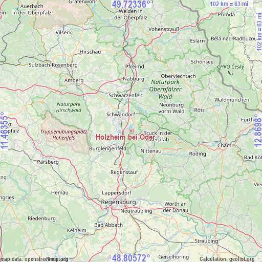
Holzheim bei Oder GPS coordinates[2]
49° 16' 0.012" North, 12° 10' 0.012" East
| Map corner | latitude | longitude |
|---|---|---|
| Upper-left | 49.72336°, | 11.46355° |
| Center: | 49.26667°, | 12.16667° |
| Lower-right: | 48.80572°, | 12.8698° |
| Map W x H: | 102×102 km | = 63.4×63.4mi |
| max Lat: | 55.01917° ⇑79.3% North |
| Holzheim bei Oder: | 49.26667° |
| min Lat: | ⇓20.7% South 47.40724° |
| min Long | Holzheim bei Od | max Long |
| 5.92978° | 12.16667° | 14.98853° |
| W 84.1%⇐ | ⇒15.9% E |
Elevation
Elevation of Holzheim bei Oder is 386 m = 1266 ft, and this is 136.9 m = 449 ft above average elevation for this country.
| Max E: |
1256 m = 4121 ft | 26.5% |
| Holzheim bei Oder | 386 m 1266 ft | |
| Avg. | 249.1 m = 817 ft | |
Min E: |
-5 m = -16 ft | 73.5% |
See also: Germany elevation on elevation.city.
Geographical zone
Holzheim bei Oder is located in North temperate zone (between Tropic of Cancer and the Arctic Circle). Distance of this North polar circle is 1923.2 km =1195 mi to North.| Distance of | km | miles | from Holzheim bei Oder |
|---|---|---|---|
| North Pole | 4529.1 | 2814.3 | to North |
| Arctic Circle | 1923.2 | 1195 | to North |
| Tropic Cancer | 2872 | 1784.6 | to South |
| Equator | 5477.9 | 3403.8 | to South |


Nearby cities:
15 places around Holzheim bei Oder: (largest is in red/bold)
• Bodenwöhr
9.8 km =6.1 mi,  87°
87°
• Breitenbrunn
15.2 km =9.4 mi,  315°
315°
• Bruck in der Oberpfalz
10.4 km =6.5 mi,  100°
100°
• Brunn
3.8 km =2.4 mi,  151°
151°
• Burglengenfeld
11.3 km =7 mi,  231°
231°
• Maxhütte-Haidhof
9.2 km =5.7 mi,  215°
215°
• Nittenau
10.9 km =6.8 mi,  137°
137°
• Regenstauf
16.5 km =10.3 mi,  189°
189°
• Reichenbach
16.2 km =10.1 mi,  124°
124°
• Schwandorf in Bayern
7.7 km =4.8 mi,  327°
327°
• Schwarzenfeld
13.7 km =8.5 mi,  350°
350°
• Steinberg
2.2 km =1.4 mi,  33°
33°
• Teublitz
7.5 km =4.7 mi, 229°
• Tiefenbach
14.5 km =9 mi,  128°
128°
• Wackersdorf
5.7 km =3.5 mi,  12°
12°
Sources, notices
• [Note1] Compared only with cities in Germany existing in our database
• [Src1] Map data: © OpenStreetMap contributors (CC-BY-SA)
• [Src2] Other city data from geonames.org with taken over terms of usage.
• [Src3] Geographical zone / Annual Mean Temperature by Robert A. Rohde @ Wikipedia
