Schwandorf in Bayern geodata
Schwandorf in Bayern (Bavaria) is a seat of a third-order administrative division; located in Germany in Europe/Berlin (GMT+2) time zone. With population of 28,235 people, there are 498 cities with bigger population in this country. Compared to other cities in Germany, 78.3% of cities are located further ↑North; 83.3% of cities are located further ←West and 70.6% of cities have lower elevation than Schwandorf in Bayern. Note1
Administrative division(s):
- Level 1: Bavaria
- Level 2: Upper Palatinate
- Level 3: Landkreis Schwandorf
- Level 4: Schwandorf


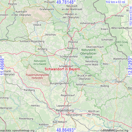
Schwandorf in Bayern GPS coordinates[2]
49° 19' 31.224" North, 12° 6' 35.28" East
| Map corner | latitude | longitude |
|---|---|---|
| Upper-left | 49.78148°, | 11.40668° |
| Center: | 49.32534°, | 12.1098° |
| Lower-right: | 48.86493°, | 12.81293° |
| Map W x H: | 101.9×101.9 km | = 63.3×63.3mi |
| max Lat: | 55.01917° ⇑78.3% North |
| Schwandorf in Bayern: | 49.32534° |
| min Lat: | ⇓21.7% South 47.40724° |
| min Long | Schwandorf in B | max Long |
| 5.92978° | 12.1098° | 14.98853° |
| W 83.3%⇐ | ⇒16.7% E |
Elevation
Elevation of Schwandorf in Bayern is 363 m = 1191 ft, and this is 113.9 m = 374 ft above average elevation for this country.
| Max E: |
1256 m = 4121 ft | 29.4% |
| Schwandorf in Bayern | 363 m 1191 ft | |
| Avg. | 249.1 m = 817 ft | |
Min E: |
-5 m = -16 ft | 70.6% |
See also: Germany elevation on elevation.city.
Geographical zone
Schwandorf in Bayern is located in North temperate zone (between Tropic of Cancer and the Arctic Circle). Distance of this North polar circle is 1916.7 km =1191 mi to North.| Distance of | km | miles | from Schwandorf in Bayern |
|---|---|---|---|
| North Pole | 4522.6 | 2810.2 | to North |
| Arctic Circle | 1916.7 | 1191 | to North |
| Tropic Cancer | 2878.5 | 1788.6 | to South |
| Equator | 5484.5 | 3407.9 | to South |


Nearby cities:
15 places around Schwandorf in Bayern: (largest is in red/bold)
• Breitenbrunn
7.8 km =4.8 mi,  303°
303°
• Brunn
11.5 km =7.1 mi,  149°
149°
• Burglengenfeld
14.3 km =8.9 mi,  199°
199°
• Ebermannsdorf
14.7 km =9.1 mi, 301°
• Ensdorf
12.7 km =7.9 mi,  277°
277°
• Holzheim bei Oder
7.7 km =4.8 mi, 147°
• Maxhütte-Haidhof
14 km =8.7 mi,  185°
185°
• Rieden
12.2 km =7.6 mi,  269°
269°
• Schmidgaden
11 km =6.8 mi,  353°
353°
• Schmidmühlen
14.8 km =9.2 mi,  245°
245°
• Schwarzenfeld
7.2 km =4.5 mi,  14°
14°
• Steinberg
7.1 km =4.4 mi,  131°
131°
• Stulln
10.3 km =6.4 mi, 9°
• Teublitz
11.5 km =7.1 mi, 188°
• Wackersdorf
5.4 km =3.4 mi,  100°
100°
Sources, notices
• [Note1] Compared only with cities in Germany existing in our database
• [Src1] Map data: © OpenStreetMap contributors (CC-BY-SA)
• [Src2] Other city data from geonames.org with taken over terms of usage.
• [Src3] Geographical zone / Annual Mean Temperature by Robert A. Rohde @ Wikipedia
