Herzlake geodata
Herzlake (Lower Saxony) is a seat of a fourth-order administrative division; located in Germany in Europe/Berlin (GMT+2) time zone. With population of 4,027 people, there are 3284 cities with bigger population in this country. Compared to other cities in Germany, 79.6% of cities are located further ↓South; 85.1% of cities are located further →East and 90.9% of cities have higher elevation than Herzlake. Note1


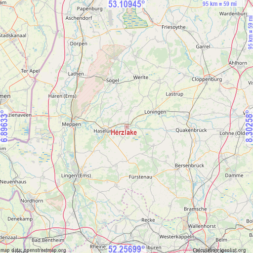
Herzlake GPS coordinates[2]
52° 41' 7.08" North, 7° 35' 58.056" East
| Map corner | latitude | longitude |
|---|---|---|
| Upper-left | 53.10945°, | 6.89633° |
| Center: | 52.6853°, | 7.59946° |
| Lower-right: | 52.25699°, | 8.30258° |
| Map W x H: | 94.8×94.8 km | = 58.9×58.9mi |
| max Lat: | 55.01917° ⇑20.4% North |
| Herzlake: | 52.6853° |
| min Lat: | ⇓79.6% South 47.40724° |
| min Long | Herzlake | max Long |
| 5.92978° | 7.59946° | 14.98853° |
| W 14.9%⇐ | ⇒85.1% E |
Elevation
Elevation of Herzlake is 19 m = 62 ft, and this is 230.1 m = 755 ft below average elevation for this country.
| Max E: |
1256 m = 4121 ft | 90.9% |
| Avg. | 249.1 m = 817 ft | |
| Herzlake | 19 m = 62 ft | |
Min E: |
-5 m = -16 ft | 9.1% |
See also: Germany elevation on elevation.city.
Geographical zone
Herzlake is located in North temperate zone (between Tropic of Cancer and the Arctic Circle). Distance of this North polar circle is 1543.1 km =958.8 mi to North.| Distance of | km | miles | from Herzlake |
|---|---|---|---|
| North Pole | 4149 | 2578.1 | to North |
| Arctic Circle | 1543.1 | 958.8 | to North |
| Tropic Cancer | 3252.1 | 2020.8 | to South |
| Equator | 5858.1 | 3640.1 | to South |


Nearby cities:
15 places around Herzlake: (largest is in red/bold)
• Berge
12 km =7.5 mi,  125°
125°
• Bippen
14.5 km =9 mi,  141°
141°
• Dohren
4.1 km =2.5 mi,  195°
195°
• Gersten
12.6 km =7.8 mi,  206°
206°
• Groß Berßen
12 km =7.5 mi,  323°
323°
• Handrup
13.5 km =8.4 mi,  186°
186°
• Haselünne
7.8 km =4.8 mi,  260°
260°
• Hüven
12.2 km =7.6 mi,  332°
332°
• Klein Berßen
13.1 km =8.1 mi,  314°
314°
• Lahn
14.7 km =9.1 mi,  4°
4°
• Lengerich
15.3 km =9.5 mi, 197°
• Lähden
7 km =4.3 mi,  343°
343°
• Löningen
12.1 km =7.5 mi,  61°
61°
• Menslage
14.6 km =9.1 mi,  90°
90°
• Wettrup
10.7 km =6.6 mi,  180°
180°
Sources, notices
• [Note1] Compared only with cities in Germany existing in our database
• [Src1] Map data: © OpenStreetMap contributors (CC-BY-SA)
• [Src2] Other city data from geonames.org with taken over terms of usage.
• [Src3] Geographical zone / Annual Mean Temperature by Robert A. Rohde @ Wikipedia
