Lähden geodata
Lähden (Lower Saxony) is a seat of a fourth-order administrative division; located in Germany in Europe/Berlin (GMT+2) time zone. With population of 4,429 people, there are 3075 cities with bigger population in this country. Compared to other cities in Germany, 80% of cities are located further ↓South; 85.5% of cities are located further →East and 85.4% of cities have higher elevation than Lähden. Note1


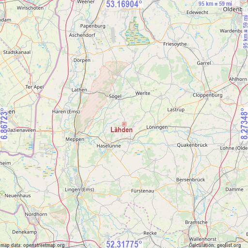
Lähden GPS coordinates[2]
52° 44' 43.692" North, 7° 34' 13.296" East
| Map corner | latitude | longitude |
|---|---|---|
| Upper-left | 53.16904°, | 6.86723° |
| Center: | 52.74547°, | 7.57036° |
| Lower-right: | 52.31775°, | 8.27348° |
| Map W x H: | 94.7×94.7 km | = 58.8×58.8mi |
| max Lat: | 55.01917° ⇑20% North |
| Lähden: | 52.74547° |
| min Lat: | ⇓80% South 47.40724° |
| min Long | Lähden | max Long |
| 5.92978° | 7.57036° | 14.98853° |
| W 14.5%⇐ | ⇒85.5% E |
Elevation
Elevation of Lähden is 34 m = 112 ft, and this is 215.1 m = 706 ft below average elevation for this country.
| Max E: |
1256 m = 4121 ft | 85.4% |
| Avg. | 249.1 m = 817 ft | |
| Lähden | 34 m = 112 ft | |
Min E: |
-5 m = -16 ft | 14.6% |
See also: Germany elevation on elevation.city.
Geographical zone
Lähden is located in North temperate zone (between Tropic of Cancer and the Arctic Circle). Distance of this North polar circle is 1536.4 km =954.7 mi to North.| Distance of | km | miles | from Lähden |
|---|---|---|---|
| North Pole | 4142.3 | 2573.9 | to North |
| Arctic Circle | 1536.4 | 954.7 | to North |
| Tropic Cancer | 3258.8 | 2024.9 | to South |
| Equator | 5864.7 | 3644.2 | to South |


Nearby cities:
15 places around Lähden: (largest is in red/bold)
• Berge
18 km =11.2 mi,  139°
139°
• Dohren
10.7 km =6.6 mi,  175°
175°
• Gersten
18.4 km =11.4 mi,  191°
191°
• Groß Berßen
5.9 km =3.7 mi,  299°
299°
• Haselünne
9.8 km =6.1 mi,  216°
216°
• Herzlake
7 km =4.3 mi,  163°
163°
• Hüven
5.5 km =3.4 mi,  319°
319°
• Klein Berßen
7.7 km =4.8 mi,  288°
288°
• Lahn
8.5 km =5.3 mi,  21°
21°
• Löningen
12.7 km =7.9 mi,  94°
94°
• Menslage
18 km =11.2 mi,  112°
112°
• Sögel
12.2 km =7.6 mi,  342°
342°
• Werlte
13.9 km =8.6 mi,  33°
33°
• Werpeloh
14.7 km =9.1 mi, 343°
• Wettrup
17.5 km =10.9 mi,  173°
173°
Sources, notices
• [Note1] Compared only with cities in Germany existing in our database
• [Src1] Map data: © OpenStreetMap contributors (CC-BY-SA)
• [Src2] Other city data from geonames.org with taken over terms of usage.
• [Src3] Geographical zone / Annual Mean Temperature by Robert A. Rohde @ Wikipedia
