Haselünne geodata
Haselünne (Lower Saxony) is a populated place; located in Germany in Europe/Berlin (GMT+2) time zone. With population of 12,562 people, there are 1291 cities with bigger population in this country. Compared to other cities in Germany, 79.4% of cities are located further ↓South; 87.1% of cities are located further →East and 88.6% of cities have higher elevation than Haselünne. Note1


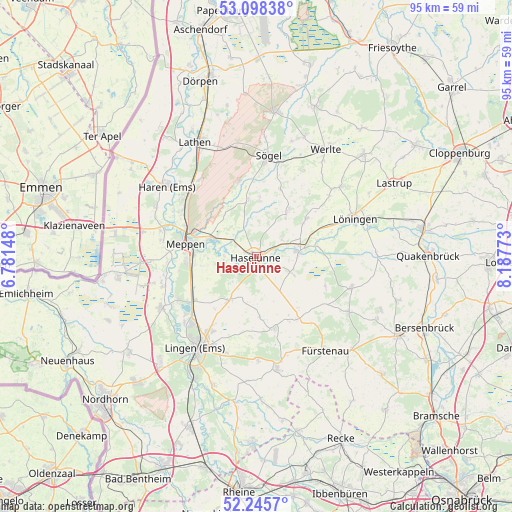
Haselünne GPS coordinates[2]
52° 40' 26.832" North, 7° 29' 4.56" East
| Map corner | latitude | longitude |
|---|---|---|
| Upper-left | 53.09838°, | 6.78148° |
| Center: | 52.67412°, | 7.4846° |
| Lower-right: | 52.2457°, | 8.18773° |
| Map W x H: | 94.8×94.8 km | = 58.9×58.9mi |
| max Lat: | 55.01917° ⇑20.6% North |
| Haselünne: | 52.67412° |
| min Lat: | ⇓79.4% South 47.40724° |
| min Long | Haselünne | max Long |
| 5.92978° | 7.4846° | 14.98853° |
| W 12.9%⇐ | ⇒87.1% E |
Elevation
Elevation of Haselünne is 25 m = 82 ft, and this is 224.1 m = 735 ft below average elevation for this country.
| Max E: |
1256 m = 4121 ft | 88.6% |
| Avg. | 249.1 m = 817 ft | |
| Haselünne | 25 m = 82 ft | |
Min E: |
-5 m = -16 ft | 11.4% |
See also: Germany elevation on elevation.city.
Geographical zone
Haselünne is located in North temperate zone (between Tropic of Cancer and the Arctic Circle). Distance of this North polar circle is 1544.4 km =959.6 mi to North.| Distance of | km | miles | from Haselünne |
|---|---|---|---|
| North Pole | 4150.2 | 2578.8 | to North |
| Arctic Circle | 1544.4 | 959.6 | to North |
| Tropic Cancer | 3250.9 | 2020 | to South |
| Equator | 5856.8 | 3639.2 | to South |


Nearby cities:
15 places around Haselünne: (largest is in red/bold)
• Bawinkel
10 km =6.2 mi,  214°
214°
• Dohren
7.2 km =4.5 mi,  111°
111°
• Geeste
16.9 km =10.5 mi,  240°
240°
• Gersten
10.3 km =6.4 mi,  167°
167°
• Groß Berßen
10.9 km =6.8 mi,  3°
3°
• Handrup
13.7 km =8.5 mi,  152°
152°
• Herzlake
7.8 km =4.8 mi,  80°
80°
• Hüven
12.3 km =7.6 mi,  10°
10°
• Klein Berßen
10.5 km =6.5 mi,  351°
351°
• Lahn
18.2 km =11.3 mi,  29°
29°
• Langen
15 km =9.3 mi,  184°
184°
• Lengerich
13.7 km =8.5 mi, 166°
• Lähden
9.8 km =6.1 mi,  36°
36°
• Meppen
13.2 km =8.2 mi,  278°
278°
• Wettrup
12.2 km =7.6 mi,  140°
140°
Sources, notices
• [Note1] Compared only with cities in Germany existing in our database
• [Src1] Map data: © OpenStreetMap contributors (CC-BY-SA)
• [Src2] Other city data from geonames.org with taken over terms of usage.
• [Src3] Geographical zone / Annual Mean Temperature by Robert A. Rohde @ Wikipedia
