Friedersdorf geodata
Friedersdorf (Thuringia) is a seat of a fourth-order administrative division; located in Germany in Europe/Berlin (GMT+2) time zone. With population of 227 people, there are 10362 cities with bigger population in this country. Compared to other cities in Germany, 50.4% of cities are located further ↑North; 67.5% of cities are located further ←West and 94.3% of cities have lower elevation than Friedersdorf. Note1


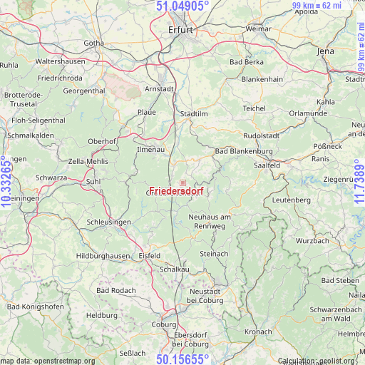
Friedersdorf GPS coordinates[2]
50° 36' 17.712" North, 11° 2' 8.772" East
| Map corner | latitude | longitude |
|---|---|---|
| Upper-left | 51.04905°, | 10.33265° |
| Center: | 50.60492°, | 11.03577° |
| Lower-right: | 50.15655°, | 11.7389° |
| Map W x H: | 99.2×99.2 km | = 61.6×61.6mi |
| max Lat: | 55.01917° ⇑50.4% North |
| Friedersdorf: | 50.60492° |
| min Lat: | ⇓49.6% South 47.40724° |
| min Long | Friedersdorf | max Long |
| 5.92978° | 11.03577° | 14.98853° |
| W 67.5%⇐ | ⇒32.5% E |
Elevation
Elevation of Friedersdorf is 580 m = 1903 ft, and this is 330.9 m = 1086 ft above average elevation for this country.
| Max E: |
1256 m = 4121 ft | 5.7% |
| Friedersdorf | 580 m 1903 ft | |
| Avg. | 249.1 m = 817 ft | |
Min E: |
-5 m = -16 ft | 94.3% |
See also: Germany elevation on elevation.city.
Geographical zone
Friedersdorf is located in North temperate zone (between Tropic of Cancer and the Arctic Circle). Distance of this North polar circle is 1774.4 km =1102.6 mi to North.| Distance of | km | miles | from Friedersdorf |
|---|---|---|---|
| North Pole | 4380.3 | 2721.8 | to North |
| Arctic Circle | 1774.4 | 1102.6 | to North |
| Tropic Cancer | 3020.8 | 1877 | to South |
| Equator | 5626.7 | 3496.3 | to South |


Nearby cities:
15 places around Friedersdorf: (largest is in red/bold)
• Altenfeld
6.5 km =4 mi,  228°
228°
• Böhlen
2 km =1.2 mi,  163°
163°
• Dröbischau
3.8 km =2.4 mi,  43°
43°
• Gehren
5.3 km =3.3 mi,  335°
335°
• Gillersdorf
1.9 km =1.2 mi,  314°
314°
• Großbreitenbach
3 km =1.9 mi,  217°
217°
• Herschdorf
2.9 km =1.8 mi,  18°
18°
• Katzhütte
6 km =3.7 mi,  168°
168°
• Königsee
7.6 km =4.7 mi,  34°
34°
• Mellenbach-Glasbach
4.7 km =2.9 mi,  73°
73°
• Meuselbach
5.4 km =3.4 mi,  133°
133°
• Möhrenbach
3.5 km =2.2 mi, 305°
• Oberhain
7.6 km =4.7 mi, 65°
• Pennewitz
6.2 km =3.9 mi,  11°
11°
• Wildenspring
2.2 km =1.4 mi,  104°
104°
Sources, notices
• [Note1] Compared only with cities in Germany existing in our database
• [Src1] Map data: © OpenStreetMap contributors (CC-BY-SA)
• [Src2] Other city data from geonames.org with taken over terms of usage.
• [Src3] Geographical zone / Annual Mean Temperature by Robert A. Rohde @ Wikipedia
