Hehlen geodata
Hehlen (Lower Saxony) is a seat of a fourth-order administrative division; located in Germany in Europe/Berlin (GMT+2) time zone. With population of 2,193 people, there are 4810 cities with bigger population in this country. Compared to other cities in Germany, 72.1% of cities are located further ↓South; 58.2% of cities are located further →East and 72.8% of cities have higher elevation than Hehlen. Note1


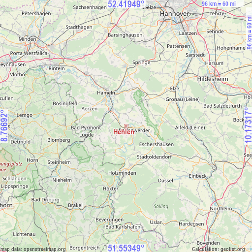
Hehlen GPS coordinates[2]
51° 59' 18.888" North, 9° 28' 12.144" East
| Map corner | latitude | longitude |
|---|---|---|
| Upper-left | 52.41949°, | 8.76692° |
| Center: | 51.98858°, | 9.47004° |
| Lower-right: | 51.55349°, | 10.17317° |
| Map W x H: | 96.3×96.3 km | = 59.8×59.8mi |
| max Lat: | 55.01917° ⇑27.9% North |
| Hehlen: | 51.98858° |
| min Lat: | ⇓72.1% South 47.40724° |
| min Long | Hehlen | max Long |
| 5.92978° | 9.47004° | 14.98853° |
| W 41.8%⇐ | ⇒58.2% E |
Elevation
Elevation of Hehlen is 73 m = 240 ft, and this is 176.1 m = 578 ft below average elevation for this country.
| Max E: |
1256 m = 4121 ft | 72.8% |
| Avg. | 249.1 m = 817 ft | |
| Hehlen | 73 m = 240 ft | |
Min E: |
-5 m = -16 ft | 27.2% |
See also: Germany elevation on elevation.city.
Geographical zone
Hehlen is located in North temperate zone (between Tropic of Cancer and the Arctic Circle). Distance of this North polar circle is 1620.6 km =1007 mi to North.| Distance of | km | miles | from Hehlen |
|---|---|---|---|
| North Pole | 4226.5 | 2626.2 | to North |
| Arctic Circle | 1620.6 | 1007 | to North |
| Tropic Cancer | 3174.7 | 1972.7 | to South |
| Equator | 5780.6 | 3591.9 | to South |


Nearby cities:
15 places around Hehlen: (largest is in red/bold)
• Bodenwerder
3.9 km =2.4 mi,  119°
119°
• Brevörde
8.8 km =5.5 mi,  204°
204°
• Dielmissen
9.6 km =6 mi,  102°
102°
• Golmbach
11.3 km =7 mi,  150°
150°
• Halle
6.5 km =4 mi,  87°
87°
• Heinsen
12 km =7.5 mi,  192°
192°
• Heyen
3.3 km =2.1 mi,  44°
44°
• Holenberg
11.1 km =6.9 mi,  135°
135°
• Kirchbrak
7.6 km =4.7 mi,  109°
109°
• Lüerdissen
11.3 km =7 mi, 110°
• Ottenstein
6.3 km =3.9 mi,  223°
223°
• Pegestorf
7 km =4.3 mi,  164°
164°
• Polle
11 km =6.8 mi, 204°
• Salzhemmendorf
11.8 km =7.3 mi, 42°
• Vahlbruch
11.6 km =7.2 mi,  229°
229°
Sources, notices
• [Note1] Compared only with cities in Germany existing in our database
• [Src1] Map data: © OpenStreetMap contributors (CC-BY-SA)
• [Src2] Other city data from geonames.org with taken over terms of usage.
• [Src3] Geographical zone / Annual Mean Temperature by Robert A. Rohde @ Wikipedia
