Ottenstein geodata
Ottenstein (Lower Saxony) is a populated place; located in Germany in Europe/Berlin (GMT+2) time zone. With population of 1,296 people, there are 6318 cities with bigger population in this country. Compared to other cities in Germany, 71.6% of cities are located further ↓South; 59.2% of cities are located further →East and 60% of cities have lower elevation than Ottenstein. Note1
Administrative division(s):
- Level 1: Lower Saxony
- Level 3: Landkreis Holzminden
- Level 4: Ottenstein, Flecken


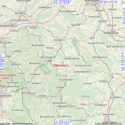
Ottenstein GPS coordinates[2]
51° 56' 49.452" North, 9° 24' 25.2" East
| Map corner | latitude | longitude |
|---|---|---|
| Upper-left | 52.37838°, | 8.70387° |
| Center: | 51.94707°, | 9.407° |
| Lower-right: | 51.51157°, | 10.11013° |
| Map W x H: | 96.4×96.4 km | = 59.9×59.9mi |
| max Lat: | 55.01917° ⇑28.4% North |
| Ottenstein: | 51.94707° |
| min Lat: | ⇓71.6% South 47.40724° |
| min Long | Ottenstein | max Long |
| 5.92978° | 9.407° | 14.98853° |
| W 40.8%⇐ | ⇒59.2% E |
Elevation
Elevation of Ottenstein is 290 m = 951 ft, and this is 40.9 m = 134 ft above average elevation for this country.
| Max E: |
1256 m = 4121 ft | 40% |
| Ottenstein | 290 m 951 ft | |
| Avg. | 249.1 m = 817 ft | |
Min E: |
-5 m = -16 ft | 60% |
See also: Germany elevation on elevation.city.
Geographical zone
Ottenstein is located in North temperate zone (between Tropic of Cancer and the Arctic Circle). Distance of this North polar circle is 1625.2 km =1009.9 mi to North.| Distance of | km | miles | from Ottenstein |
|---|---|---|---|
| North Pole | 4231.1 | 2629.1 | to North |
| Arctic Circle | 1625.2 | 1009.9 | to North |
| Tropic Cancer | 3170.1 | 1969.8 | to South |
| Equator | 5776 | 3589 | to South |


Nearby cities:
15 places around Ottenstein: (largest is in red/bold)
• Bad Pyrmont
11.4 km =7.1 mi,  292°
292°
• Bevern
11.5 km =7.1 mi,  148°
148°
• Bodenwerder
8.2 km =5.1 mi,  70°
70°
• Brevörde
3.4 km =2.1 mi,  168°
168°
• Golmbach
11.1 km =6.9 mi,  118°
118°
• Halle
11.9 km =7.4 mi, 65°
• Hehlen
6.3 km =3.9 mi,  43°
43°
• Heinsen
7.3 km =4.5 mi, 165°
• Heyen
9.6 km =6 mi, 43°
• Holenberg
12.6 km =7.8 mi,  105°
105°
• Kirchbrak
11.7 km =7.3 mi,  79°
79°
• Lügde
11 km =6.8 mi,  276°
276°
• Pegestorf
6.5 km =4 mi, 109°
• Polle
5.4 km =3.4 mi,  182°
182°
• Vahlbruch
5.4 km =3.4 mi,  237°
237°
Sources, notices
• [Note1] Compared only with cities in Germany existing in our database
• [Src1] Map data: © OpenStreetMap contributors (CC-BY-SA)
• [Src2] Other city data from geonames.org with taken over terms of usage.
• [Src3] Geographical zone / Annual Mean Temperature by Robert A. Rohde @ Wikipedia
