Harpstedt geodata
Harpstedt (Lower Saxony) is a populated place; located in Germany in Europe/Berlin (GMT+2) time zone. With population of 4,558 people, there are 3006 cities with bigger population in this country. Compared to other cities in Germany, 81.1% of cities are located further ↓South; 70.3% of cities are located further →East and 85.8% of cities have higher elevation than Harpstedt. Note1
Administrative division(s):
- Level 1: Lower Saxony
- Level 3: Landkreis Oldenburg
- Level 4: Harpstedt, Flecken


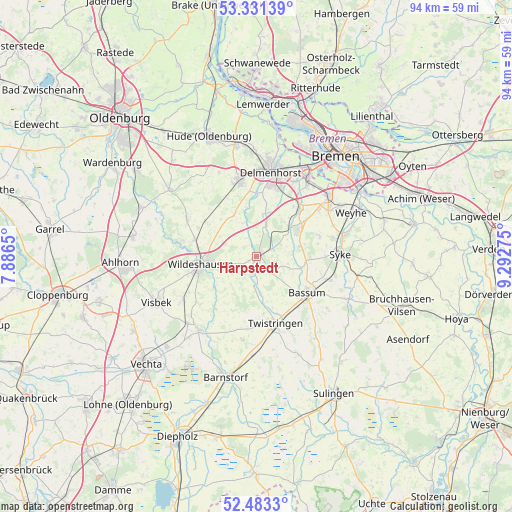
Harpstedt GPS coordinates[2]
52° 54' 33.912" North, 8° 35' 22.632" East
| Map corner | latitude | longitude |
|---|---|---|
| Upper-left | 53.33139°, | 7.8865° |
| Center: | 52.90942°, | 8.58962° |
| Lower-right: | 52.4833°, | 9.29275° |
| Map W x H: | 94.3×94.3 km | = 58.6×58.6mi |
| max Lat: | 55.01917° ⇑18.9% North |
| Harpstedt: | 52.90942° |
| min Lat: | ⇓81.1% South 47.40724° |
| min Long | Harpstedt | max Long |
| 5.92978° | 8.58962° | 14.98853° |
| W 29.7%⇐ | ⇒70.3% E |
Elevation
Elevation of Harpstedt is 33 m = 108 ft, and this is 216.1 m = 709 ft below average elevation for this country.
| Max E: |
1256 m = 4121 ft | 85.8% |
| Avg. | 249.1 m = 817 ft | |
| Harpstedt | 33 m = 108 ft | |
Min E: |
-5 m = -16 ft | 14.2% |
See also: Germany elevation on elevation.city.
Geographical zone
Harpstedt is located in North temperate zone (between Tropic of Cancer and the Arctic Circle). Distance of this North polar circle is 1518.2 km =943.4 mi to North.| Distance of | km | miles | from Harpstedt |
|---|---|---|---|
| North Pole | 4124.1 | 2562.6 | to North |
| Arctic Circle | 1518.2 | 943.4 | to North |
| Tropic Cancer | 3277.1 | 2036.3 | to South |
| Equator | 5883 | 3655.5 | to South |


Nearby cities:
15 places around Harpstedt: (largest is in red/bold)
• Bassum
11.4 km =7.1 mi,  125°
125°
• Beckeln
4.8 km =3 mi,  185°
185°
• Colnrade
11.1 km =6.9 mi,  220°
220°
• Delmenhorst
16 km =9.9 mi,  9°
9°
• Dötlingen
14.1 km =8.8 mi,  280°
280°
• Dünsen
4 km =2.5 mi,  60°
60°
• Ganderkesee
14.3 km =8.9 mi,  344°
344°
• Goldenstedt
17.1 km =10.6 mi, 218°
• Groß Ippener
6.6 km =4.1 mi,  15°
15°
• Kirchseelte
7.7 km =4.8 mi,  54°
54°
• Prinzhöfte
4.8 km =3 mi, 341°
• Syke
15.6 km =9.7 mi,  88°
88°
• Twistringen
12.7 km =7.9 mi,  164°
164°
• Wildeshausen
10.6 km =6.6 mi,  260°
260°
• Winkelsett
6.1 km =3.8 mi, 218°
Sources, notices
• [Note1] Compared only with cities in Germany existing in our database
• [Src1] Map data: © OpenStreetMap contributors (CC-BY-SA)
• [Src2] Other city data from geonames.org with taken over terms of usage.
• [Src3] Geographical zone / Annual Mean Temperature by Robert A. Rohde @ Wikipedia
