Twistringen geodata
Twistringen (Lower Saxony) is a populated place; located in Germany in Europe/Berlin (GMT+2) time zone. With population of 12,645 people, there are 1280 cities with bigger population in this country. Compared to other cities in Germany, 80.4% of cities are located further ↓South; 69.7% of cities are located further →East and 77% of cities have higher elevation than Twistringen. Note1


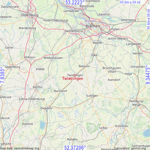
Twistringen GPS coordinates[2]
52° 47' 57.336" North, 8° 38' 29.868" East
| Map corner | latitude | longitude |
|---|---|---|
| Upper-left | 53.2223°, | 7.9385° |
| Center: | 52.79926°, | 8.64163° |
| Lower-right: | 52.37206°, | 9.34475° |
| Map W x H: | 94.5×94.5 km | = 58.7×58.7mi |
| max Lat: | 55.01917° ⇑19.6% North |
| Twistringen: | 52.79926° |
| min Lat: | ⇓80.4% South 47.40724° |
| min Long | Twistringen | max Long |
| 5.92978° | 8.64163° | 14.98853° |
| W 30.3%⇐ | ⇒69.7% E |
Elevation
Elevation of Twistringen is 56 m = 184 ft, and this is 193.1 m = 634 ft below average elevation for this country.
| Max E: |
1256 m = 4121 ft | 77% |
| Avg. | 249.1 m = 817 ft | |
| Twistringen | 56 m = 184 ft | |
Min E: |
-5 m = -16 ft | 23% |
See also: Germany elevation on elevation.city.
Geographical zone
Twistringen is located in North temperate zone (between Tropic of Cancer and the Arctic Circle). Distance of this North polar circle is 1530.4 km =950.9 mi to North.| Distance of | km | miles | from Twistringen |
|---|---|---|---|
| North Pole | 4136.3 | 2570.2 | to North |
| Arctic Circle | 1530.4 | 950.9 | to North |
| Tropic Cancer | 3264.8 | 2028.7 | to South |
| Equator | 5870.7 | 3647.9 | to South |


Nearby cities:
15 places around Twistringen: (largest is in red/bold)
• Barnstorf
13.6 km =8.5 mi,  223°
223°
• Bassum
8.1 km =5 mi,  45°
45°
• Beckeln
8.5 km =5.3 mi,  332°
332°
• Colnrade
11.3 km =7 mi,  289°
289°
• Drentwede
8 km =5 mi, 219°
• Dünsen
14.3 km =8.9 mi,  0°
0°
• Ehrenburg
6.7 km =4.2 mi,  144°
144°
• Eydelstedt
13.5 km =8.4 mi,  208°
208°
• Goldenstedt
14.1 km =8.8 mi,  265°
265°
• Harpstedt
12.7 km =7.9 mi,  344°
344°
• Neuenkirchen
7.7 km =4.8 mi,  109°
109°
• Scholen
11.2 km =7 mi,  131°
131°
• Schwaförden
14.4 km =8.9 mi,  118°
118°
• Sudwalde
13.1 km =8.1 mi,  92°
92°
• Winkelsett
10.4 km =6.5 mi,  315°
315°
Sources, notices
• [Note1] Compared only with cities in Germany existing in our database
• [Src1] Map data: © OpenStreetMap contributors (CC-BY-SA)
• [Src2] Other city data from geonames.org with taken over terms of usage.
• [Src3] Geographical zone / Annual Mean Temperature by Robert A. Rohde @ Wikipedia
