Beckeln geodata
Beckeln (Lower Saxony) is a seat of a fourth-order administrative division; located in Germany in Europe/Berlin (GMT+2) time zone. With population of 852 people, there are 7695 cities with bigger population in this country. Compared to other cities in Germany, 80.8% of cities are located further ↓South; 70.3% of cities are located further →East and 86.3% of cities have higher elevation than Beckeln. Note1


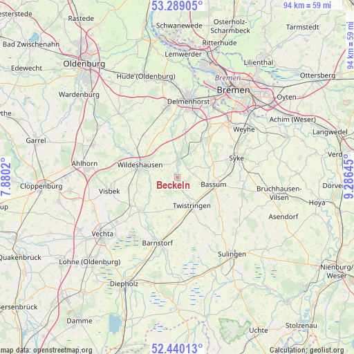
Beckeln GPS coordinates[2]
52° 52' 0.012" North, 8° 34' 59.988" East
| Map corner | latitude | longitude |
|---|---|---|
| Upper-left | 53.28905°, | 7.8802° |
| Center: | 52.86667°, | 8.58333° |
| Lower-right: | 52.44013°, | 9.28645° |
| Map W x H: | 94.4×94.4 km | = 58.7×58.7mi |
| max Lat: | 55.01917° ⇑19.2% North |
| Beckeln: | 52.86667° |
| min Lat: | ⇓80.8% South 47.40724° |
| min Long | Beckeln | max Long |
| 5.92978° | 8.58333° | 14.98853° |
| W 29.7%⇐ | ⇒70.3% E |
Elevation
Elevation of Beckeln is 32 m = 105 ft, and this is 217.1 m = 712 ft below average elevation for this country.
| Max E: |
1256 m = 4121 ft | 86.3% |
| Avg. | 249.1 m = 817 ft | |
| Beckeln | 32 m = 105 ft | |
Min E: |
-5 m = -16 ft | 13.7% |
See also: Germany elevation on elevation.city.
Geographical zone
Beckeln is located in North temperate zone (between Tropic of Cancer and the Arctic Circle). Distance of this North polar circle is 1523 km =946.3 mi to North.| Distance of | km | miles | from Beckeln |
|---|---|---|---|
| North Pole | 4128.8 | 2565.5 | to North |
| Arctic Circle | 1523 | 946.3 | to North |
| Tropic Cancer | 3272.3 | 2033.3 | to South |
| Equator | 5878.2 | 3652.5 | to South |


Nearby cities:
15 places around Beckeln: (largest is in red/bold)
• Bassum
9.9 km =6.2 mi,  100°
100°
• Colnrade
7.7 km =4.8 mi,  241°
241°
• Drentwede
13.7 km =8.5 mi,  185°
185°
• Dötlingen
15.3 km =9.5 mi,  298°
298°
• Dünsen
7.8 km =4.8 mi,  30°
30°
• Ehrenburg
15.2 km =9.4 mi,  148°
148°
• Goldenstedt
13.4 km =8.3 mi,  229°
229°
• Groß Ippener
11.3 km =7 mi,  11°
11°
• Harpstedt
4.8 km =3 mi, 5°
• Kirchseelte
11.4 km =7.1 mi,  35°
35°
• Neuenkirchen
15.1 km =9.4 mi,  131°
131°
• Prinzhöfte
9.3 km =5.8 mi,  353°
353°
• Twistringen
8.5 km =5.3 mi, 152°
• Wildeshausen
10.5 km =6.5 mi,  287°
287°
• Winkelsett
3.4 km =2.1 mi,  270°
270°
Sources, notices
• [Note1] Compared only with cities in Germany existing in our database
• [Src1] Map data: © OpenStreetMap contributors (CC-BY-SA)
• [Src2] Other city data from geonames.org with taken over terms of usage.
• [Src3] Geographical zone / Annual Mean Temperature by Robert A. Rohde @ Wikipedia
