Goßwitz geodata
Goßwitz (Thuringia) is a populated place; located in Germany in Europe/Berlin (GMT+2) time zone. With population of 1,379 people, there are 6122 cities with bigger population in this country. Compared to other cities in Germany, 50.4% of cities are located further ↓South; 74% of cities are located further ←West and 78.3% of cities have lower elevation than Goßwitz. Note1
Administrative division(s):
- Level 1: Thuringia
- Level 3: Saalfeld-Rudolstadt
- Level 4: Unterwellenborn


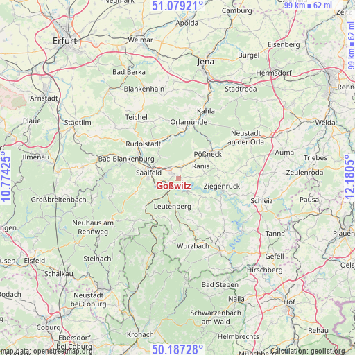
Goßwitz GPS coordinates[2]
50° 38' 7.296" North, 11° 28' 38.532" East
| Map corner | latitude | longitude |
|---|---|---|
| Upper-left | 51.07921°, | 10.77425° |
| Center: | 50.63536°, | 11.47737° |
| Lower-right: | 50.18728°, | 12.1805° |
| Map W x H: | 99.2×99.2 km | = 61.6×61.6mi |
| max Lat: | 55.01917° ⇑49.6% North |
| Goßwitz: | 50.63536° |
| min Lat: | ⇓50.4% South 47.40724° |
| min Long | Goßwitz | max Long |
| 5.92978° | 11.47737° | 14.98853° |
| W 74%⇐ | ⇒26% E |
Elevation
Elevation of Goßwitz is 422 m = 1385 ft, and this is 172.9 m = 567 ft above average elevation for this country.
| Max E: |
1256 m = 4121 ft | 21.7% |
| Goßwitz | 422 m 1385 ft | |
| Avg. | 249.1 m = 817 ft | |
Min E: |
-5 m = -16 ft | 78.3% |
See also: Germany elevation on elevation.city.
Geographical zone
Goßwitz is located in North temperate zone (between Tropic of Cancer and the Arctic Circle). Distance of this North polar circle is 1771 km =1100.4 mi to North.| Distance of | km | miles | from Goßwitz |
|---|---|---|---|
| North Pole | 4376.9 | 2719.7 | to North |
| Arctic Circle | 1771 | 1100.4 | to North |
| Tropic Cancer | 3024.2 | 1879.2 | to South |
| Equator | 5630.1 | 3498.4 | to South |


Nearby cities:
15 places around Goßwitz: (largest is in red/bold)
• Birkigt
3.8 km =2.4 mi,  7°
7°
• Gössitz
7.8 km =4.8 mi,  100°
100°
• Hohenwarte
4 km =2.5 mi,  173°
173°
• Kamsdorf
1.9 km =1.2 mi,  297°
297°
• Kaulsdorf
3.8 km =2.4 mi,  236°
236°
• Krölpa
6.4 km =4 mi,  42°
42°
• Könitz
1.8 km =1.1 mi,  25°
25°
• Leutenberg
8.1 km =5 mi,  190°
190°
• Ranis
7.1 km =4.4 mi,  65°
65°
• Reichenbach
6.2 km =3.9 mi,  332°
332°
• Saalfeld
8 km =5 mi,  280°
280°
• Schmorda
7.8 km =4.8 mi,  82°
82°
• Seisla
4.4 km =2.7 mi, 67°
• Unterwellenborn
3.5 km =2.2 mi, 297°
• Wilhelmsdorf
5.1 km =3.2 mi, 97°
Sources, notices
• [Note1] Compared only with cities in Germany existing in our database
• [Src1] Map data: © OpenStreetMap contributors (CC-BY-SA)
• [Src2] Other city data from geonames.org with taken over terms of usage.
• [Src3] Geographical zone / Annual Mean Temperature by Robert A. Rohde @ Wikipedia
