Unterwellenborn geodata
Unterwellenborn (Thuringia) is a seat of a fourth-order administrative division; located in Germany in Europe/Berlin (GMT+2) time zone. With population of 3,002 people, there are 3995 cities with bigger population in this country. Compared to other cities in Germany, 50.7% of cities are located further ↓South; 73.2% of cities are located further ←West and 60.9% of cities have lower elevation than Unterwellenborn. Note1
Administrative division(s):
- Level 1: Thuringia
- Level 3: Saalfeld-Rudolstadt
- Level 4: Unterwellenborn


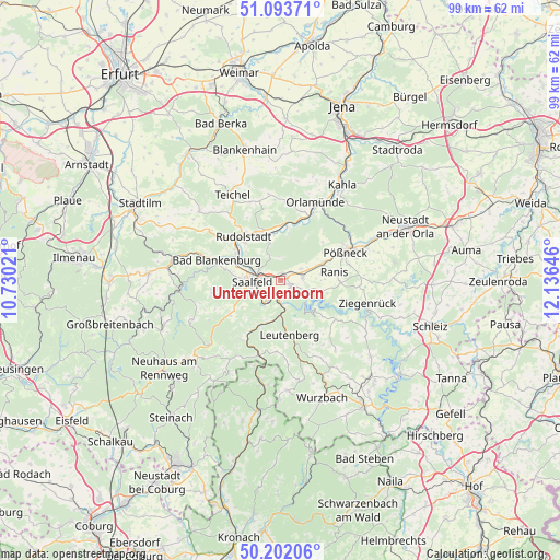
Unterwellenborn GPS coordinates[2]
50° 39' 0" North, 11° 25' 59.988" East
| Map corner | latitude | longitude |
|---|---|---|
| Upper-left | 51.09371°, | 10.73021° |
| Center: | 50.65°, | 11.43333° |
| Lower-right: | 50.20206°, | 12.13646° |
| Map W x H: | 99.1×99.1 km | = 61.6×61.6mi |
| max Lat: | 55.01917° ⇑49.3% North |
| Unterwellenborn: | 50.65° |
| min Lat: | ⇓50.7% South 47.40724° |
| min Long | Unterwellenborn | max Long |
| 5.92978° | 11.43333° | 14.98853° |
| W 73.2%⇐ | ⇒26.8% E |
Elevation
Elevation of Unterwellenborn is 295 m = 968 ft, and this is 45.9 m = 151 ft above average elevation for this country.
| Max E: |
1256 m = 4121 ft | 39.1% |
| Unterwellenborn | 295 m 968 ft | |
| Avg. | 249.1 m = 817 ft | |
Min E: |
-5 m = -16 ft | 60.9% |
See also: Germany elevation on elevation.city.
Geographical zone
Unterwellenborn is located in North temperate zone (between Tropic of Cancer and the Arctic Circle). Distance of this North polar circle is 1769.4 km =1099.5 mi to North.| Distance of | km | miles | from Unterwellenborn |
|---|---|---|---|
| North Pole | 4375.3 | 2718.7 | to North |
| Arctic Circle | 1769.4 | 1099.5 | to North |
| Tropic Cancer | 3025.8 | 1880.1 | to South |
| Equator | 5631.8 | 3499.4 | to South |


Nearby cities:
15 places around Unterwellenborn: (largest is in red/bold)
• Birkigt
4.2 km =2.6 mi,  59°
59°
• Goßwitz
3.5 km =2.2 mi,  117°
117°
• Herschdorf
10 km =6.2 mi,  46°
46°
• Hohenwarte
6.6 km =4.1 mi,  147°
147°
• Kamsdorf
1.6 km =1 mi, 117°
• Kaulsdorf
3.7 km =2.3 mi,  180°
180°
• Krölpa
8 km =5 mi,  67°
67°
• Könitz
3.9 km =2.4 mi,  90°
90°
• Leutenberg
9.7 km =6 mi,  170°
170°
• Naundorf
6.8 km =4.2 mi,  346°
346°
• Ranis
9.7 km =6 mi,  82°
82°
• Reichenbach
3.9 km =2.4 mi,  3°
3°
• Saalfeld
4.8 km =3 mi,  267°
267°
• Seisla
7.2 km =4.5 mi, 89°
• Wilhelmsdorf
8.5 km =5.3 mi,  105°
105°
Sources, notices
• [Note1] Compared only with cities in Germany existing in our database
• [Src1] Map data: © OpenStreetMap contributors (CC-BY-SA)
• [Src2] Other city data from geonames.org with taken over terms of usage.
• [Src3] Geographical zone / Annual Mean Temperature by Robert A. Rohde @ Wikipedia
