Fuchsmühl geodata
Fuchsmühl (Bavaria) is a populated place; located in Germany in Europe/Berlin (GMT+2) time zone. With population of 1,774 people, there are 5390 cities with bigger population in this country. Compared to other cities in Germany, 65.8% of cities are located further ↑North; 83.8% of cities are located further ←West and 95% of cities have lower elevation than Fuchsmühl. Note1
Administrative division(s):
- Level 1: Bavaria
- Level 2: Upper Palatinate
- Level 3: Landkreis Tirschenreuth
- Level 4: Fuchsmühl, Markt


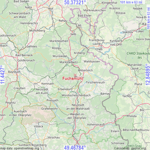
Fuchsmühl GPS coordinates[2]
49° 55' 21.54" North, 12° 8' 44.952" East
| Map corner | latitude | longitude |
|---|---|---|
| Upper-left | 50.37321°, | 11.4427° |
| Center: | 49.92265°, | 12.14582° |
| Lower-right: | 49.46784°, | 12.84895° |
| Map W x H: | 100.7×100.7 km | = 62.6×62.6mi |
| max Lat: | 55.01917° ⇑65.8% North |
| Fuchsmühl: | 49.92265° |
| min Lat: | ⇓34.2% South 47.40724° |
| min Long | Fuchsmühl | max Long |
| 5.92978° | 12.14582° | 14.98853° |
| W 83.8%⇐ | ⇒16.2% E |
Elevation
Elevation of Fuchsmühl is 599 m = 1965 ft, and this is 349.9 m = 1148 ft above average elevation for this country.
| Max E: |
1256 m = 4121 ft | 5% |
| Fuchsmühl | 599 m 1965 ft | |
| Avg. | 249.1 m = 817 ft | |
Min E: |
-5 m = -16 ft | 95% |
See also: Germany elevation on elevation.city.
Geographical zone
Fuchsmühl is located in North temperate zone (between Tropic of Cancer and the Arctic Circle). Distance of this North polar circle is 1850.3 km =1149.7 mi to North.| Distance of | km | miles | from Fuchsmühl |
|---|---|---|---|
| North Pole | 4456.2 | 2769 | to North |
| Arctic Circle | 1850.3 | 1149.7 | to North |
| Tropic Cancer | 2945 | 1829.9 | to South |
| Equator | 5550.9 | 3449.2 | to South |


Nearby cities:
15 places around Fuchsmühl: (largest is in red/bold)
• Bad Alexandersbad
13.9 km =8.6 mi,  318°
318°
• Berg
12.1 km =7.5 mi,  181°
181°
• Erbendorf
11.7 km =7.3 mi,  217°
217°
• Falkenberg
9.2 km =5.7 mi,  140°
140°
• Friedenfels
5.5 km =3.4 mi, 215°
• Krummennaab
10.5 km =6.5 mi,  198°
198°
• Leonberg
10.3 km =6.4 mi,  74°
74°
• Marktredwitz
10.1 km =6.3 mi,  334°
334°
• Mitterteich
7.6 km =4.7 mi, 65°
• Neusorg
12.9 km =8 mi,  275°
275°
• Pechbrunn
5.1 km =3.2 mi,  16°
16°
• Pullenreuth
10.5 km =6.5 mi, 276°
• Waldershof
8.8 km =5.5 mi, 317°
• Wiesau
3.5 km =2.2 mi,  117°
117°
• Windischeschenbach
13.5 km =8.4 mi, 176°
Sources, notices
• [Note1] Compared only with cities in Germany existing in our database
• [Src1] Map data: © OpenStreetMap contributors (CC-BY-SA)
• [Src2] Other city data from geonames.org with taken over terms of usage.
• [Src3] Geographical zone / Annual Mean Temperature by Robert A. Rohde @ Wikipedia
