Windischeschenbach geodata
Windischeschenbach (Bavaria) is a populated place; located in Germany in Europe/Berlin (GMT+2) time zone. With population of 5,659 people, there are 2578 cities with bigger population in this country. Compared to other cities in Germany, 68.8% of cities are located further ↑North; 84% of cities are located further ←West and 82.6% of cities have lower elevation than Windischeschenbach. Note1
Administrative division(s):
- Level 1: Bavaria
- Level 2: Upper Palatinate
- Level 3: Landkreis Neustadt an der Waldnaab
- Level 4: Windischeschenbach


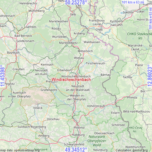
Windischeschenbach GPS coordinates[2]
49° 48' 3.888" North, 12° 9' 25.56" East
| Map corner | latitude | longitude |
|---|---|---|
| Upper-left | 50.25278°, | 11.45398° |
| Center: | 49.80108°, | 12.1571° |
| Lower-right: | 49.34512°, | 12.86023° |
| Map W x H: | 100.9×100.9 km | = 62.7×62.7mi |
| max Lat: | 55.01917° ⇑68.8% North |
| Windischeschenbach: | 49.80108° |
| min Lat: | ⇓31.2% South 47.40724° |
| min Long | Windischeschenb | max Long |
| 5.92978° | 12.1571° | 14.98853° |
| W 84%⇐ | ⇒16% E |
Elevation
Elevation of Windischeschenbach is 450 m = 1476 ft, and this is 200.9 m = 659 ft above average elevation for this country.
| Max E: |
1256 m = 4121 ft | 17.4% |
| Windischeschenbach | 450 m 1476 ft | |
| Avg. | 249.1 m = 817 ft | |
Min E: |
-5 m = -16 ft | 82.6% |
See also: Germany elevation on elevation.city.
Geographical zone
Windischeschenbach is located in North temperate zone (between Tropic of Cancer and the Arctic Circle). Distance of this North polar circle is 1863.8 km =1158.1 mi to North.| Distance of | km | miles | from Windischeschenbach |
|---|---|---|---|
| North Pole | 4469.7 | 2777.3 | to North |
| Arctic Circle | 1863.8 | 1158.1 | to North |
| Tropic Cancer | 2931.4 | 1821.5 | to South |
| Equator | 5537.4 | 3440.8 | to South |


Nearby cities:
15 places around Windischeschenbach: (largest is in red/bold)
• Berg
1.8 km =1.1 mi,  322°
322°
• Erbendorf
9.1 km =5.7 mi,  298°
298°
• Falkenberg
8.1 km =5 mi,  38°
38°
• Floß
12.1 km =7.5 mi,  135°
135°
• Friedenfels
9.9 km =6.2 mi,  336°
336°
• Fuchsmühl
13.5 km =8.4 mi,  356°
356°
• Kirchendemenreuth
4.5 km =2.8 mi,  244°
244°
• Konradsreuth
12 km =7.5 mi,  123°
123°
• Krummennaab
5.4 km =3.4 mi,  311°
311°
• Neustadt an der Waldnaab
7.7 km =4.8 mi,  168°
168°
• Parkstein
10.3 km =6.4 mi,  218°
218°
• Püchersreuth
7.9 km =4.9 mi, 136°
• Störnstein
8.4 km =5.2 mi,  155°
155°
• Theisseil
13.3 km =8.3 mi, 157°
• Wiesau
12.1 km =7.5 mi,  10°
10°
Sources, notices
• [Note1] Compared only with cities in Germany existing in our database
• [Src1] Map data: © OpenStreetMap contributors (CC-BY-SA)
• [Src2] Other city data from geonames.org with taken over terms of usage.
• [Src3] Geographical zone / Annual Mean Temperature by Robert A. Rohde @ Wikipedia
