Frankenberg geodata
Frankenberg (Saxony) is a populated place; located in Germany in Europe/Berlin (GMT+2) time zone. With population of 16,850 people, there are 939 cities with bigger population in this country. Compared to other cities in Germany, 56.4% of cities are located further ↓South; 92.6% of cities are located further ←West and 58.1% of cities have lower elevation than Frankenberg. Note1
Administrative division(s):
- Level 1: Saxony
- Level 3: Landkreis Mittelsachsen
- Level 4: Frankenberg/Sa.


Frankenberg GPS coordinates[2]
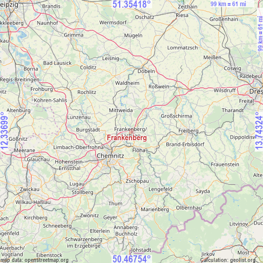
50° 54' 46.692" North, 13° 2' 24.396" East
| Map corner | latitude | longitude |
|---|---|---|
| Upper-left | 51.35418°, | 12.33699° |
| Center: | 50.91297°, | 13.04011° |
| Lower-right: | 50.46754°, | 13.74324° |
| Map W x H: | 98.6×98.6 km | = 61.3×61.3mi |
| max Lat: | 55.01917° ⇑43.6% North |
| Frankenberg: | 50.91297° |
| min Lat: | ⇓56.4% South 47.40724° |
| min Long | Frankenberg | max Long |
| 5.92978° | 13.04011° | 14.98853° |
| W 92.6%⇐ | ⇒7.4% E |
Elevation
Elevation of Frankenberg is 279 m = 915 ft, and this is 29.9 m = 98 ft above average elevation for this country.
| Max E: |
1256 m = 4121 ft | 41.9% |
| Frankenberg | 279 m 915 ft | |
| Avg. | 249.1 m = 817 ft | |
Min E: |
-5 m = -16 ft | 58.1% |
See also: Germany elevation on elevation.city.
Geographical zone
Frankenberg is located in North temperate zone (between Tropic of Cancer and the Arctic Circle). Distance of this North polar circle is 1740.2 km =1081.3 mi to North.| Distance of | km | miles | from Frankenberg |
|---|---|---|---|
| North Pole | 4346.1 | 2700.5 | to North |
| Arctic Circle | 1740.2 | 1081.3 | to North |
| Tropic Cancer | 3055.1 | 1898.4 | to South |
| Equator | 5661 | 3517.6 | to South |


Nearby cities:
15 places around Frankenberg: (largest is in red/bold)
• Altmittweida
8.7 km =5.4 mi,  313°
313°
• Augustusburg
12 km =7.5 mi,  158°
158°
• Chemnitz
11.6 km =7.2 mi,  222°
222°
• Claußnitz
11.2 km =7 mi,  281°
281°
• Erlau
12.6 km =7.8 mi,  328°
328°
• Falkenau
8.4 km =5.2 mi,  139°
139°
• Flöha
6.8 km =4.2 mi, 159°
• Frankenstein
11.9 km =7.4 mi,  96°
96°
• Hainichen
8.6 km =5.3 mi,  42°
42°
• Hilbersdorf
9.2 km =5.7 mi, 224°
• Mittweida
9.3 km =5.8 mi, 330°
• Niederwiesa
5.4 km =3.4 mi,  197°
197°
• Oederan
10.9 km =6.8 mi,  122°
122°
• Rossau
9.9 km =6.2 mi,  10°
10°
• Wittgensdorf
12.4 km =7.7 mi,  254°
254°
In other languages:
- In German: Frankenberg/Sa.
- In Italian: Frankenberg/Sa.
- In Russian: Франкенберг
- In Chinese: 弗蘭肯貝格
Sources, notices
• [Note1] Compared only with cities in Germany existing in our database
• [Src1] Map data: © OpenStreetMap contributors (CC-BY-SA)
• [Src2] Other city data from geonames.org with taken over terms of usage.
• [Src3] Geographical zone / Annual Mean Temperature by Robert A. Rohde @ Wikipedia
