Fischbeck geodata
Fischbeck (Saxony-Anhalt) is a populated place; located in Germany in Europe/Berlin (GMT+2) time zone. With population of 706 people, there are 8286 cities with bigger population in this country. Compared to other cities in Germany, 77.9% of cities are located further ↓South; 82% of cities are located further ←West and 84.9% of cities have higher elevation than Fischbeck. Note1
Administrative division(s):
- Level 1: Saxony-Anhalt
- Level 3: Landkreis Stendal
- Level 4: Wust-Fischbeck


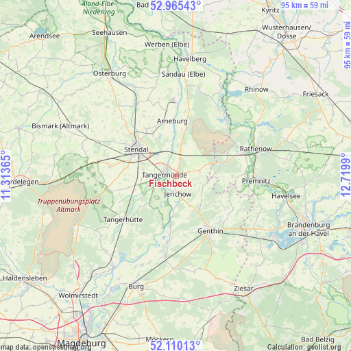
Fischbeck GPS coordinates[2]
52° 32' 23.496" North, 12° 1' 0.372" East
| Map corner | latitude | longitude |
|---|---|---|
| Upper-left | 52.96543°, | 11.31365° |
| Center: | 52.53986°, | 12.01677° |
| Lower-right: | 52.11013°, | 12.7199° |
| Map W x H: | 95.1×95.1 km | = 59.1×59.1mi |
| max Lat: | 55.01917° ⇑22.1% North |
| Fischbeck: | 52.53986° |
| min Lat: | ⇓77.9% South 47.40724° |
| min Long | Fischbeck | max Long |
| 5.92978° | 12.01677° | 14.98853° |
| W 82%⇐ | ⇒18% E |
Elevation
Elevation of Fischbeck is 35 m = 115 ft, and this is 214.1 m = 702 ft below average elevation for this country.
| Max E: |
1256 m = 4121 ft | 84.9% |
| Avg. | 249.1 m = 817 ft | |
| Fischbeck | 35 m = 115 ft | |
Min E: |
-5 m = -16 ft | 15.1% |
See also: Germany elevation on elevation.city.
Geographical zone
Fischbeck is located in North temperate zone (between Tropic of Cancer and the Arctic Circle). Distance of this North polar circle is 1559.3 km =968.9 mi to North.| Distance of | km | miles | from Fischbeck |
|---|---|---|---|
| North Pole | 4165.2 | 2588.1 | to North |
| Arctic Circle | 1559.3 | 968.9 | to North |
| Tropic Cancer | 3236 | 2010.8 | to South |
| Equator | 5841.9 | 3630 | to South |


Nearby cities:
15 places around Fischbeck: (largest is in red/bold)
• Arneburg
15.1 km =9.4 mi,  357°
357°
• Bittkau
14.5 km =9 mi,  194°
194°
• Dahlen
13.1 km =8.1 mi,  280°
280°
• Ferchland
11.1 km =6.9 mi, 186°
• Grieben
12 km =7.5 mi,  198°
198°
• Hassel
12.7 km =7.9 mi,  331°
331°
• Heeren
8.8 km =5.5 mi,  272°
272°
• Jarchau
15.2 km =9.4 mi, 327°
• Jerichow
4.4 km =2.7 mi,  173°
173°
• Klietz
14.7 km =9.1 mi,  13°
13°
• Redekin
9 km =5.6 mi,  153°
153°
• Schönhausen
4.8 km =3 mi,  18°
18°
• Stendal
13 km =8.1 mi,  304°
304°
• Tangermünde
2.8 km =1.7 mi, 281°
• Wust
6.7 km =4.2 mi,  78°
78°
Sources, notices
• [Note1] Compared only with cities in Germany existing in our database
• [Src1] Map data: © OpenStreetMap contributors (CC-BY-SA)
• [Src2] Other city data from geonames.org with taken over terms of usage.
• [Src3] Geographical zone / Annual Mean Temperature by Robert A. Rohde @ Wikipedia
