Dahlen geodata
Dahlen (Saxony-Anhalt) is a populated place; located in Germany in Europe/Berlin (GMT+2) time zone. With population of 701 people, there are 8308 cities with bigger population in this country. Compared to other cities in Germany, 78.2% of cities are located further ↓South; 79.2% of cities are located further ←West and 84.1% of cities have higher elevation than Dahlen. Note1


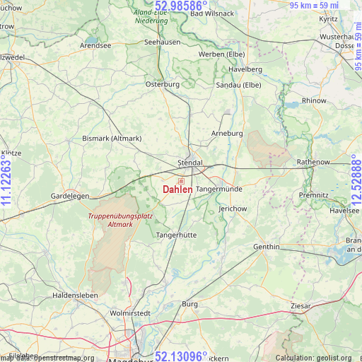
Dahlen GPS coordinates[2]
52° 33' 37.764" North, 11° 49' 32.7" East
| Map corner | latitude | longitude |
|---|---|---|
| Upper-left | 52.98586°, | 11.12263° |
| Center: | 52.56049°, | 11.82575° |
| Lower-right: | 52.13096°, | 12.52888° |
| Map W x H: | 95.1×95.1 km | = 59.1×59.1mi |
| max Lat: | 55.01917° ⇑21.8% North |
| Dahlen: | 52.56049° |
| min Lat: | ⇓78.2% South 47.40724° |
| min Long | Dahlen | max Long |
| 5.92978° | 11.82575° | 14.98853° |
| W 79.2%⇐ | ⇒20.8% E |
Elevation
Elevation of Dahlen is 37 m = 121 ft, and this is 212.1 m = 696 ft below average elevation for this country.
| Max E: |
1256 m = 4121 ft | 84.1% |
| Avg. | 249.1 m = 817 ft | |
| Dahlen | 37 m = 121 ft | |
Min E: |
-5 m = -16 ft | 15.9% |
See also: Germany elevation on elevation.city.
Geographical zone
Dahlen is located in North temperate zone (between Tropic of Cancer and the Arctic Circle). Distance of this North polar circle is 1557 km =967.5 mi to North.| Distance of | km | miles | from Dahlen |
|---|---|---|---|
| North Pole | 4162.9 | 2586.7 | to North |
| Arctic Circle | 1557 | 967.5 | to North |
| Tropic Cancer | 3238.3 | 2012.2 | to South |
| Equator | 5844.2 | 3631.4 | to South |


Nearby cities:
15 places around Dahlen: (largest is in red/bold)
• Badingen
13.5 km =8.4 mi,  293°
293°
• Fischbeck
13.1 km =8.1 mi,  100°
100°
• Hassel
11.1 km =6.9 mi,  37°
37°
• Heeren
4.6 km =2.9 mi,  115°
115°
• Insel
4.9 km =3 mi,  271°
271°
• Jarchau
11.6 km =7.2 mi,  24°
24°
• Jerichow
15 km =9.3 mi, 116°
• Kläden
13.7 km =8.5 mi,  305°
305°
• Lüderitz
8 km =5 mi,  224°
224°
• Möringen
6.4 km =4 mi,  302°
302°
• Schönhausen
14.6 km =9.1 mi,  81°
81°
• Stendal
5.6 km =3.5 mi, 23°
• Tangerhütte
14 km =8.7 mi,  185°
185°
• Tangermünde
10.3 km =6.4 mi, 99°
• Uenglingen
6.5 km =4 mi,  349°
349°
Sources, notices
• [Note1] Compared only with cities in Germany existing in our database
• [Src1] Map data: © OpenStreetMap contributors (CC-BY-SA)
• [Src2] Other city data from geonames.org with taken over terms of usage.
• [Src3] Geographical zone / Annual Mean Temperature by Robert A. Rohde @ Wikipedia
