Dingsleben geodata
Dingsleben (Thuringia) is a seat of a fourth-order administrative division; located in Germany in Europe/Berlin (GMT+2) time zone. With population of 266 people, there are 10182 cities with bigger population in this country. Compared to other cities in Germany, 54% of cities are located further ↑North; 60.8% of cities are located further ←West and 79.1% of cities have lower elevation than Dingsleben. Note1
Administrative division(s):
- Level 1: Thuringia
- Level 3: Landkreis Hildburghausen
- Level 4: Dingsleben


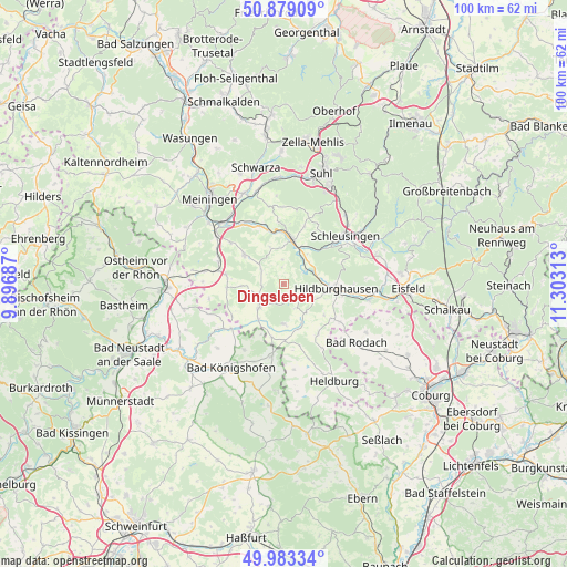
Dingsleben GPS coordinates[2]
50° 25' 59.988" North, 10° 36' 0" East
| Map corner | latitude | longitude |
|---|---|---|
| Upper-left | 50.87909°, | 9.89687° |
| Center: | 50.43333°, | 10.6° |
| Lower-right: | 49.98334°, | 11.30313° |
| Map W x H: | 99.6×99.6 km | = 61.9×61.9mi |
| max Lat: | 55.01917° ⇑54% North |
| Dingsleben: | 50.43333° |
| min Lat: | ⇓46% South 47.40724° |
| min Long | Dingsleben | max Long |
| 5.92978° | 10.6° | 14.98853° |
| W 60.8%⇐ | ⇒39.2% E |
Elevation
Elevation of Dingsleben is 428 m = 1404 ft, and this is 178.9 m = 587 ft above average elevation for this country.
| Max E: |
1256 m = 4121 ft | 20.9% |
| Dingsleben | 428 m 1404 ft | |
| Avg. | 249.1 m = 817 ft | |
Min E: |
-5 m = -16 ft | 79.1% |
See also: Germany elevation on elevation.city.
Geographical zone
Dingsleben is located in North temperate zone (between Tropic of Cancer and the Arctic Circle). Distance of this North polar circle is 1793.5 km =1114.4 mi to North.| Distance of | km | miles | from Dingsleben |
|---|---|---|---|
| North Pole | 4399.4 | 2733.7 | to North |
| Arctic Circle | 1793.5 | 1114.4 | to North |
| Tropic Cancer | 3001.7 | 1865.2 | to South |
| Equator | 5607.7 | 3484.5 | to South |


Nearby cities:
15 places around Dingsleben: (largest is in red/bold)
• Beinerstadt
3.7 km =2.3 mi,  0°
0°
• Ehrenberg
6.6 km =4.1 mi,  32°
32°
• Exdorf
4.9 km =3 mi,  303°
303°
• Gleichamberg
7 km =4.3 mi,  181°
181°
• Grimmelshausen
6 km =3.7 mi,  22°
22°
• Henfstädt
9.3 km =5.8 mi,  354°
354°
• Hildburghausen
9.4 km =5.8 mi,  95°
95°
• Jüchsen
8.7 km =5.4 mi,  306°
306°
• Kloster Veßra
8.2 km =5.1 mi, 25°
• Leutersdorf
9.9 km =6.2 mi,  339°
339°
• Milz
7.6 km =4.7 mi,  215°
215°
• Queienfeld
10.4 km =6.5 mi,  280°
280°
• Reurieth
4 km =2.5 mi,  62°
62°
• Römhild
6 km =3.7 mi,  226°
226°
• Themar
8 km =5 mi,  7°
7°
Sources, notices
• [Note1] Compared only with cities in Germany existing in our database
• [Src1] Map data: © OpenStreetMap contributors (CC-BY-SA)
• [Src2] Other city data from geonames.org with taken over terms of usage.
• [Src3] Geographical zone / Annual Mean Temperature by Robert A. Rohde @ Wikipedia
