Engelthal geodata
Engelthal (Bavaria) is a seat of a fourth-order administrative division; located in Germany in Europe/Berlin (GMT+2) time zone. With population of 1,093 people, there are 6866 cities with bigger population in this country. Compared to other cities in Germany, 76.2% of cities are located further ↑North; 72.7% of cities are located further ←West and 71.8% of cities have lower elevation than Engelthal. Note1
Administrative division(s):
- Level 1: Bavaria
- Level 2: Regierungsbezirk Mittelfranken
- Level 3: Nürnberger Land
- Level 4: Engelthal


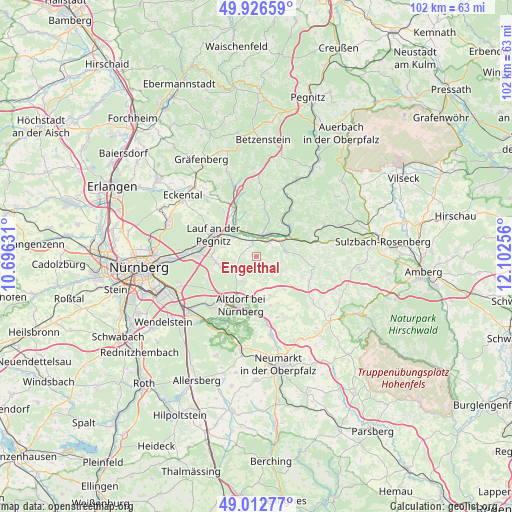
Engelthal GPS coordinates[2]
49° 28' 18.516" North, 11° 23' 57.948" East
| Map corner | latitude | longitude |
|---|---|---|
| Upper-left | 49.92659°, | 10.69631° |
| Center: | 49.47181°, | 11.39943° |
| Lower-right: | 49.01277°, | 12.10256° |
| Map W x H: | 101.6×101.6 km | = 63.1×63.1mi |
| max Lat: | 55.01917° ⇑76.2% North |
| Engelthal: | 49.47181° |
| min Lat: | ⇓23.8% South 47.40724° |
| min Long | Engelthal | max Long |
| 5.92978° | 11.39943° | 14.98853° |
| W 72.7%⇐ | ⇒27.3% E |
Elevation
Elevation of Engelthal is 373 m = 1224 ft, and this is 123.9 m = 406 ft above average elevation for this country.
| Max E: |
1256 m = 4121 ft | 28.2% |
| Engelthal | 373 m 1224 ft | |
| Avg. | 249.1 m = 817 ft | |
Min E: |
-5 m = -16 ft | 71.8% |
See also: Germany elevation on elevation.city.
Geographical zone
Engelthal is located in North temperate zone (between Tropic of Cancer and the Arctic Circle). Distance of this North polar circle is 1900.4 km =1180.9 mi to North.| Distance of | km | miles | from Engelthal |
|---|---|---|---|
| North Pole | 4506.3 | 2800.1 | to North |
| Arctic Circle | 1900.4 | 1180.9 | to North |
| Tropic Cancer | 2894.8 | 1798.7 | to South |
| Equator | 5500.7 | 3418 | to South |


Nearby cities:
15 places around Engelthal: (largest is in red/bold)
• Altdorf
10.1 km =6.3 mi,  197°
197°
• Happurg
5.7 km =3.5 mi,  64°
64°
• Henfenfeld
3 km =1.9 mi,  347°
347°
• Hersbruck
4.9 km =3 mi,  28°
28°
• Kirchensittenbach
9.5 km =5.9 mi,  9°
9°
• Lauf an der Pegnitz
9.7 km =6 mi,  298°
298°
• Leinburg
6.8 km =4.2 mi,  250°
250°
• Neunkirchen am Sand
8.2 km =5.1 mi,  315°
315°
• Offenhausen
2.7 km =1.7 mi,  158°
158°
• Ottensoos
5.9 km =3.7 mi, 315°
• Pommelsbrunn
8.8 km =5.5 mi,  65°
65°
• Reichenschwand
5.1 km =3.2 mi,  337°
337°
• Rückersdorf
11.3 km =7 mi,  284°
284°
• Schnaittach
10.6 km =6.6 mi, 337°
• Stöckelsberg
10.1 km =6.3 mi, 164°
Sources, notices
• [Note1] Compared only with cities in Germany existing in our database
• [Src1] Map data: © OpenStreetMap contributors (CC-BY-SA)
• [Src2] Other city data from geonames.org with taken over terms of usage.
• [Src3] Geographical zone / Annual Mean Temperature by Robert A. Rohde @ Wikipedia
