Pommelsbrunn geodata
Pommelsbrunn (Bavaria) is a seat of a fourth-order administrative division; located in Germany in Europe/Berlin (GMT+2) time zone. With population of 5,432 people, there are 2656 cities with bigger population in this country. Compared to other cities in Germany, 75.6% of cities are located further ↑North; 74.5% of cities are located further ←West and 71.6% of cities have lower elevation than Pommelsbrunn. Note1
Administrative division(s):
- Level 1: Bavaria
- Level 2: Regierungsbezirk Mittelfranken
- Level 3: Nürnberger Land
- Level 4: Pommelsbrunn


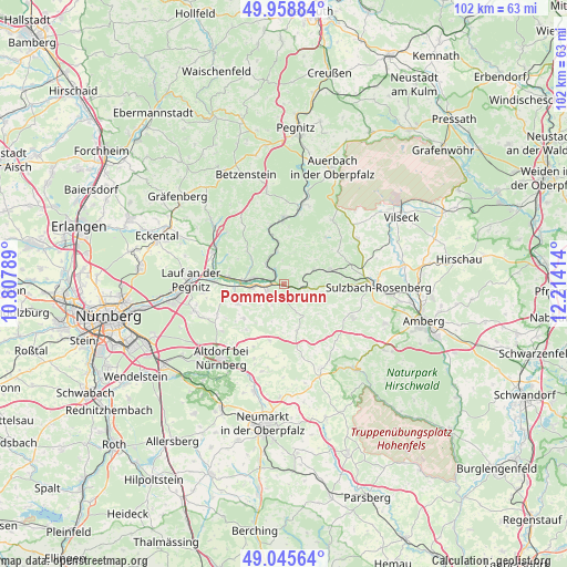
Pommelsbrunn GPS coordinates[2]
49° 30' 15.732" North, 11° 30' 39.636" East
| Map corner | latitude | longitude |
|---|---|---|
| Upper-left | 49.95884°, | 10.80789° |
| Center: | 49.50437°, | 11.51101° |
| Lower-right: | 49.04564°, | 12.21414° |
| Map W x H: | 101.5×101.5 km | = 63.1×63.1mi |
| max Lat: | 55.01917° ⇑75.6% North |
| Pommelsbrunn: | 49.50437° |
| min Lat: | ⇓24.4% South 47.40724° |
| min Long | Pommelsbrunn | max Long |
| 5.92978° | 11.51101° | 14.98853° |
| W 74.5%⇐ | ⇒25.5% E |
Elevation
Elevation of Pommelsbrunn is 371 m = 1217 ft, and this is 121.9 m = 400 ft above average elevation for this country.
| Max E: |
1256 m = 4121 ft | 28.4% |
| Pommelsbrunn | 371 m 1217 ft | |
| Avg. | 249.1 m = 817 ft | |
Min E: |
-5 m = -16 ft | 71.6% |
See also: Germany elevation on elevation.city.
Geographical zone
Pommelsbrunn is located in North temperate zone (between Tropic of Cancer and the Arctic Circle). Distance of this North polar circle is 1896.8 km =1178.6 mi to North.| Distance of | km | miles | from Pommelsbrunn |
|---|---|---|---|
| North Pole | 4502.7 | 2797.8 | to North |
| Arctic Circle | 1896.8 | 1178.6 | to North |
| Tropic Cancer | 2898.5 | 1801 | to South |
| Equator | 5504.4 | 3420.3 | to South |


Nearby cities:
15 places around Pommelsbrunn: (largest is in red/bold)
• Alfeld
8.4 km =5.2 mi,  160°
160°
• Engelthal
8.8 km =5.5 mi,  245°
245°
• Etzelwang
6 km =3.7 mi,  64°
64°
• Happurg
3.1 km =1.9 mi, 247°
• Hartenstein
10.6 km =6.6 mi,  2°
2°
• Henfenfeld
8.7 km =5.4 mi,  265°
265°
• Hersbruck
5.8 km =3.6 mi,  277°
277°
• Hirschbach
5.3 km =3.3 mi,  17°
17°
• Kirchensittenbach
8.6 km =5.3 mi,  311°
311°
• Offenhausen
9.3 km =5.8 mi,  229°
229°
• Ottensoos
12.2 km =7.6 mi, 272°
• Reichenschwand
10 km =6.2 mi, 276°
• Velden
12.2 km =7.6 mi,  359°
359°
• Vorra
6 km =3.7 mi,  348°
348°
• Weigendorf
4.2 km =2.6 mi,  100°
100°
Sources, notices
• [Note1] Compared only with cities in Germany existing in our database
• [Src1] Map data: © OpenStreetMap contributors (CC-BY-SA)
• [Src2] Other city data from geonames.org with taken over terms of usage.
• [Src3] Geographical zone / Annual Mean Temperature by Robert A. Rohde @ Wikipedia
