Rückersdorf geodata
Rückersdorf (Bavaria) is a seat of a fourth-order administrative division; located in Germany in Europe/Berlin (GMT+2) time zone. With population of 4,518 people, there are 3029 cities with bigger population in this country. Compared to other cities in Germany, 75.8% of cities are located further ↑North; 70.6% of cities are located further ←West and 66.2% of cities have lower elevation than Rückersdorf. Note1
Administrative division(s):
- Level 1: Bavaria
- Level 2: Regierungsbezirk Mittelfranken
- Level 3: Nürnberger Land
- Level 4: Rückersdorf


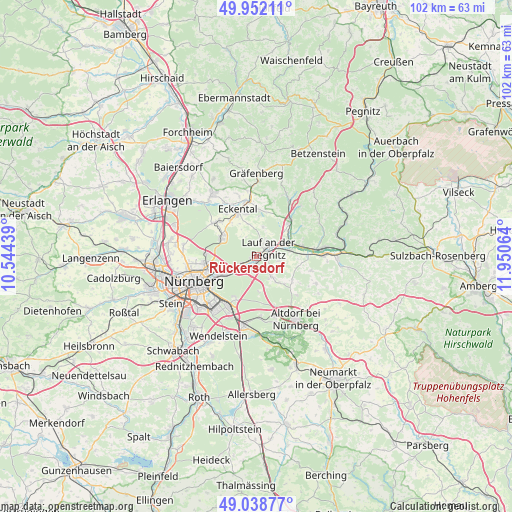
Rückersdorf GPS coordinates[2]
49° 29' 51.252" North, 11° 14' 51.036" East
| Map corner | latitude | longitude |
|---|---|---|
| Upper-left | 49.95211°, | 10.54439° |
| Center: | 49.49757°, | 11.24751° |
| Lower-right: | 49.03877°, | 11.95064° |
| Map W x H: | 101.6×101.6 km | = 63.1×63.1mi |
| max Lat: | 55.01917° ⇑75.8% North |
| Rückersdorf: | 49.49757° |
| min Lat: | ⇓24.2% South 47.40724° |
| min Long | Rückersdorf | max Long |
| 5.92978° | 11.24751° | 14.98853° |
| W 70.6%⇐ | ⇒29.4% E |
Elevation
Elevation of Rückersdorf is 330 m = 1083 ft, and this is 80.9 m = 265 ft above average elevation for this country.
| Max E: |
1256 m = 4121 ft | 33.8% |
| Rückersdorf | 330 m 1083 ft | |
| Avg. | 249.1 m = 817 ft | |
Min E: |
-5 m = -16 ft | 66.2% |
See also: Germany elevation on elevation.city.
Geographical zone
Rückersdorf is located in North temperate zone (between Tropic of Cancer and the Arctic Circle). Distance of this North polar circle is 1897.6 km =1179.1 mi to North.| Distance of | km | miles | from Rückersdorf |
|---|---|---|---|
| North Pole | 4503.4 | 2798.3 | to North |
| Arctic Circle | 1897.6 | 1179.1 | to North |
| Tropic Cancer | 2897.7 | 1800.5 | to South |
| Equator | 5503.6 | 3419.8 | to South |


Nearby cities:
15 places around Rückersdorf: (largest is in red/bold)
• Engelthal
11.3 km =7 mi,  104°
104°
• Henfenfeld
10.3 km =6.4 mi,  89°
89°
• Heroldsberg
7.7 km =4.8 mi,  300°
300°
• Kalchreuth
10.6 km =6.6 mi,  309°
309°
• Kleinsendelbach
12.7 km =7.9 mi,  329°
329°
• Lauf an der Pegnitz
3.1 km =1.9 mi,  54°
54°
• Leinburg
6.8 km =4.2 mi,  138°
138°
• Neunkirchen am Sand
6 km =3.7 mi,  59°
59°
• Ottensoos
6.9 km =4.3 mi,  78°
78°
• Reichenschwand
9.2 km =5.7 mi, 78°
• Röthenbach an der Pegnitz
1.7 km =1.1 mi,  195°
195°
• Schnaittach
9.8 km =6.1 mi, 45°
• Schwaig
4.6 km =2.9 mi,  227°
227°
• Simmelsdorf
12.9 km =8 mi,  30°
30°
• Winkelhaid
12.6 km =7.8 mi,  162°
162°
Sources, notices
• [Note1] Compared only with cities in Germany existing in our database
• [Src1] Map data: © OpenStreetMap contributors (CC-BY-SA)
• [Src2] Other city data from geonames.org with taken over terms of usage.
• [Src3] Geographical zone / Annual Mean Temperature by Robert A. Rohde @ Wikipedia
