Eichwalde geodata
Eichwalde (Brandenburg) is a seat of a fourth-order administrative division; located in Germany in Europe/Berlin (GMT+2) time zone. With population of 5,849 people, there are 2505 cities with bigger population in this country. Compared to other cities in Germany, 75.8% of cities are located further ↓South; 96.4% of cities are located further ←West and 84.5% of cities have higher elevation than Eichwalde. Note1
Administrative division(s):
- Level 1: Brandenburg
- Level 3: Landkreis Dahme-Spreewald
- Level 4: Eichwalde


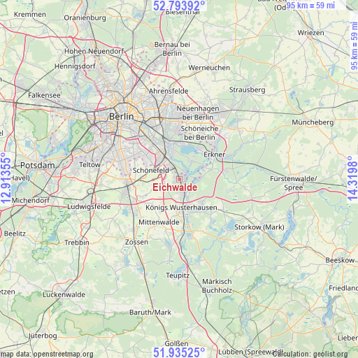
Eichwalde GPS coordinates[2]
52° 22' 0.012" North, 13° 37' 0.012" East
| Map corner | latitude | longitude |
|---|---|---|
| Upper-left | 52.79392°, | 12.91355° |
| Center: | 52.36667°, | 13.61667° |
| Lower-right: | 51.93525°, | 14.3198° |
| Map W x H: | 95.5×95.5 km | = 59.3×59.3mi |
| max Lat: | 55.01917° ⇑24.2% North |
| Eichwalde: | 52.36667° |
| min Lat: | ⇓75.8% South 47.40724° |
| min Long | Eichwalde | max Long |
| 5.92978° | 13.61667° | 14.98853° |
| W 96.4%⇐ | ⇒3.6% E |
Elevation
Elevation of Eichwalde is 36 m = 118 ft, and this is 213.1 m = 699 ft below average elevation for this country.
| Max E: |
1256 m = 4121 ft | 84.5% |
| Avg. | 249.1 m = 817 ft | |
| Eichwalde | 36 m = 118 ft | |
Min E: |
-5 m = -16 ft | 15.5% |
See also: Germany elevation on elevation.city.
Geographical zone
Eichwalde is located in North temperate zone (between Tropic of Cancer and the Arctic Circle). Distance of this North polar circle is 1578.5 km =980.8 mi to North.| Distance of | km | miles | from Eichwalde |
|---|---|---|---|
| North Pole | 4184.4 | 2600.1 | to North |
| Arctic Circle | 1578.5 | 980.8 | to North |
| Tropic Cancer | 3216.7 | 1998.8 | to South |
| Equator | 5822.6 | 3618 | to South |


Nearby cities:
15 places around Eichwalde: (largest is in red/bold)
• Adlershof
8.9 km =5.5 mi,  328°
328°
• Altglienicke
7.4 km =4.6 mi,  311°
311°
• Berlin Köpenick
8.8 km =5.5 mi,  344°
344°
• Bohnsdorf
4.3 km =2.7 mi,  316°
316°
• Friedrichshagen
9.3 km =5.8 mi,  3°
3°
• Grünau
6.1 km =3.8 mi, 336°
• Königs Wusterhausen
7.3 km =4.5 mi,  171°
171°
• Köpenick
9.2 km =5.7 mi, 341°
• Müggelheim
5.9 km =3.7 mi,  32°
32°
• Rahnsdorf
9.6 km =6 mi, 29°
• Schmöckwitz
2.4 km =1.5 mi,  67°
67°
• Schulzendorf
1.6 km =1 mi,  232°
232°
• Schönefeld
8.1 km =5 mi,  287°
287°
• Wildau
5.7 km =3.5 mi, 168°
• Zeuthen
2.1 km =1.3 mi, 170°
Sources, notices
• [Note1] Compared only with cities in Germany existing in our database
• [Src1] Map data: © OpenStreetMap contributors (CC-BY-SA)
• [Src2] Other city data from geonames.org with taken over terms of usage.
• [Src3] Geographical zone / Annual Mean Temperature by Robert A. Rohde @ Wikipedia
