Schleusingen geodata
Schleusingen (Thuringia) is a populated place; located in Germany in Europe/Berlin (GMT+2) time zone. With population of 5,842 people, there are 2509 cities with bigger population in this country. Compared to other cities in Germany, 52.6% of cities are located further ↑North; 63.3% of cities are located further ←West and 76.8% of cities have lower elevation than Schleusingen. Note1
Administrative division(s):
- Level 1: Thuringia
- Level 3: Landkreis Hildburghausen
- Level 4: Schleusingen


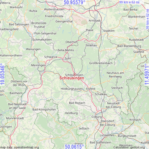
Schleusingen GPS coordinates[2]
50° 30' 38.736" North, 10° 45' 23.688" East
| Map corner | latitude | longitude |
|---|---|---|
| Upper-left | 50.95579°, | 10.05346° |
| Center: | 50.51076°, | 10.75658° |
| Lower-right: | 50.0615°, | 11.45971° |
| Map W x H: | 99.4×99.4 km | = 61.8×61.8mi |
| max Lat: | 55.01917° ⇑52.6% North |
| Schleusingen: | 50.51076° |
| min Lat: | ⇓47.4% South 47.40724° |
| min Long | Schleusingen | max Long |
| 5.92978° | 10.75658° | 14.98853° |
| W 63.3%⇐ | ⇒36.7% E |
Elevation
Elevation of Schleusingen is 411 m = 1348 ft, and this is 161.9 m = 531 ft above average elevation for this country.
| Max E: |
1256 m = 4121 ft | 23.2% |
| Schleusingen | 411 m 1348 ft | |
| Avg. | 249.1 m = 817 ft | |
Min E: |
-5 m = -16 ft | 76.8% |
See also: Germany elevation on elevation.city.
Geographical zone
Schleusingen is located in North temperate zone (between Tropic of Cancer and the Arctic Circle). Distance of this North polar circle is 1784.9 km =1109.1 mi to North.| Distance of | km | miles | from Schleusingen |
|---|---|---|---|
| North Pole | 4390.8 | 2728.3 | to North |
| Arctic Circle | 1784.9 | 1109.1 | to North |
| Tropic Cancer | 3010.4 | 1870.6 | to South |
| Equator | 5616.3 | 3489.8 | to South |


Nearby cities:
15 places around Schleusingen: (largest is in red/bold)
• Ahlstädt
5.8 km =3.6 mi,  295°
295°
• Bischofrod
8.7 km =5.4 mi, 300°
• Ehrenberg
8.1 km =5 mi,  247°
247°
• Eichenberg
7.7 km =4.8 mi, 304°
• Frauenwald
10.9 km =6.8 mi,  41°
41°
• Grimmelshausen
9.2 km =5.7 mi, 250°
• Grub
9.7 km =6 mi, 296°
• Hildburghausen
9.6 km =6 mi,  190°
190°
• Kloster Veßra
7.6 km =4.7 mi,  260°
260°
• Lengfeld
7.9 km =4.9 mi,  288°
288°
• Reurieth
10.1 km =6.3 mi,  228°
228°
• Sankt Kilian
1.9 km =1.2 mi,  13°
13°
• Schmiedefeld am Rennsteig
11.6 km =7.2 mi,  20°
20°
• Suhl
11.8 km =7.3 mi,  337°
337°
• Themar
10 km =6.2 mi,  266°
266°
Sources, notices
• [Note1] Compared only with cities in Germany existing in our database
• [Src1] Map data: © OpenStreetMap contributors (CC-BY-SA)
• [Src2] Other city data from geonames.org with taken over terms of usage.
• [Src3] Geographical zone / Annual Mean Temperature by Robert A. Rohde @ Wikipedia
