Murg geodata
Murg (Baden-Württemberg) is a seat of a fourth-order administrative division; located in Germany in Europe/Berlin (GMT+2) time zone. With population of 6,821 people, there are 2229 cities with bigger population in this country. Compared to other cities in Germany, 99.9% of cities are located further ↑North; 76.7% of cities are located further →East and 62.9% of cities have lower elevation than Murg. Note1
Administrative division(s):
- Level 1: Baden-Württemberg
- Level 2: Freiburg Region
- Level 3: Landkreis Waldshut
- Level 4: Murg


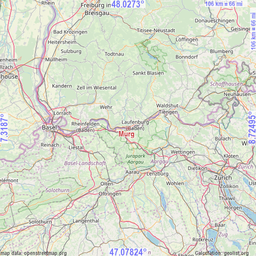
Murg GPS coordinates[2]
47° 33' 17.712" North, 8° 1' 18.552" East
| Map corner | latitude | longitude |
|---|---|---|
| Upper-left | 48.0273°, | 7.3187° |
| Center: | 47.55492°, | 8.02182° |
| Lower-right: | 47.07824°, | 8.72495° |
| Map W x H: | 105.5×105.5 km | = 65.6×65.6mi |
| max Lat: | 55.01917° ⇑99.9% North |
| Murg: | 47.55492° |
| min Lat: | ⇓0.1% South 47.40724° |
| min Long | Murg | max Long |
| 5.92978° | 8.02182° | 14.98853° |
| W 23.3%⇐ | ⇒76.7% E |
Elevation
Elevation of Murg is 308 m = 1010 ft, and this is 58.9 m = 193 ft above average elevation for this country.
| Max E: |
1256 m = 4121 ft | 37.1% |
| Murg | 308 m 1010 ft | |
| Avg. | 249.1 m = 817 ft | |
Min E: |
-5 m = -16 ft | 62.9% |
See also: Germany elevation on elevation.city.
Geographical zone
Murg is located in North temperate zone (between Tropic of Cancer and the Arctic Circle). Distance of this North polar circle is 2113.6 km =1313.3 mi to North.| Distance of | km | miles | from Murg |
|---|---|---|---|
| North Pole | 4719.5 | 2932.6 | to North |
| Arctic Circle | 2113.6 | 1313.3 | to North |
| Tropic Cancer | 2681.7 | 1666.3 | to South |
| Equator | 5287.6 | 3285.6 | to South |


Nearby cities:
15 places around Murg: (largest is in red/bold)
• Albbruck
9 km =5.6 mi,  63°
63°
• Bad Säckingen
5.7 km =3.5 mi,  268°
268°
• Dogern
12.5 km =7.8 mi, 60°
• Görwihl
10.5 km =6.5 mi,  22°
22°
• Hasel
14.4 km =8.9 mi,  319°
319°
• Hausen
19.6 km =12.2 mi, 315°
• Herrischried
12.5 km =7.8 mi,  352°
352°
• Ibach
20.1 km =12.5 mi,  9°
9°
• Laufenburg
3.1 km =1.9 mi,  68°
68°
• Rheinfelden
17.6 km =10.9 mi, 271°
• Rickenbach
7.8 km =4.8 mi,  335°
335°
• Schopfheim
18.5 km =11.5 mi,  305°
305°
• Schwörstadt
11.6 km =7.2 mi,  291°
291°
• Waldshut-Tiengen
16.5 km =10.3 mi, 62°
• Wehr
12.1 km =7.5 mi, 313°
Sources, notices
• [Note1] Compared only with cities in Germany existing in our database
• [Src1] Map data: © OpenStreetMap contributors (CC-BY-SA)
• [Src2] Other city data from geonames.org with taken over terms of usage.
• [Src3] Geographical zone / Annual Mean Temperature by Robert A. Rohde @ Wikipedia
