Crimla geodata
Crimla (Thuringia) is a seat of a fourth-order administrative division; located in Germany in Europe/Berlin (GMT+2) time zone. With population of 358 people, there are 9838 cities with bigger population in this country. Compared to other cities in Germany, 54.1% of cities are located further ↓South; 82.5% of cities are located further ←West and 60.4% of cities have lower elevation than Crimla. Note1


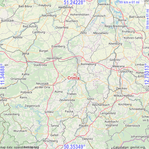
Crimla GPS coordinates[2]
50° 48' 0" North, 12° 3' 0" East
| Map corner | latitude | longitude |
|---|---|---|
| Upper-left | 51.24228°, | 11.34688° |
| Center: | 50.8°, | 12.05° |
| Lower-right: | 50.35349°, | 12.75313° |
| Map W x H: | 98.8×98.8 km | = 61.4×61.4mi |
| max Lat: | 55.01917° ⇑45.9% North |
| Crimla: | 50.8° |
| min Lat: | ⇓54.1% South 47.40724° |
| min Long | Crimla | max Long |
| 5.92978° | 12.05° | 14.98853° |
| W 82.5%⇐ | ⇒17.5% E |
Elevation
Elevation of Crimla is 292 m = 958 ft, and this is 42.9 m = 141 ft above average elevation for this country.
| Max E: |
1256 m = 4121 ft | 39.6% |
| Crimla | 292 m 958 ft | |
| Avg. | 249.1 m = 817 ft | |
Min E: |
-5 m = -16 ft | 60.4% |
See also: Germany elevation on elevation.city.
Geographical zone
Crimla is located in North temperate zone (between Tropic of Cancer and the Arctic Circle). Distance of this North polar circle is 1752.7 km =1089.1 mi to North.| Distance of | km | miles | from Crimla |
|---|---|---|---|
| North Pole | 4358.6 | 2708.3 | to North |
| Arctic Circle | 1752.7 | 1089.1 | to North |
| Tropic Cancer | 3042.5 | 1890.5 | to South |
| Equator | 5648.4 | 3509.8 | to South |


Nearby cities:
15 places around Crimla: (largest is in red/bold)
• Bocka
6.1 km =3.8 mi,  287°
287°
• Endschütz
6.2 km =3.9 mi,  103°
103°
• Gera
9.2 km =5.7 mi,  14°
14°
• Hilbersdorf
7.3 km =4.5 mi,  75°
75°
• Hohenölsen
7 km =4.3 mi,  158°
158°
• Hundhaupten
6 km =3.7 mi,  308°
308°
• Lederhose
9.4 km =5.8 mi,  270°
270°
• Münchenbernsdorf
8.6 km =5.3 mi, 285°
• Saara
8.1 km =5 mi, 313°
• Schömberg
5 km =3.1 mi,  205°
205°
• Steinsdorf
5.6 km =3.5 mi,  180°
180°
• Teichwitz
6 km =3.7 mi, 157°
• Weida
2.9 km =1.8 mi,  165°
165°
• Wünschendorf
3.4 km =2.1 mi, 96°
• Zedlitz
2.2 km =1.4 mi,  327°
327°
Sources, notices
• [Note1] Compared only with cities in Germany existing in our database
• [Src1] Map data: © OpenStreetMap contributors (CC-BY-SA)
• [Src2] Other city data from geonames.org with taken over terms of usage.
• [Src3] Geographical zone / Annual Mean Temperature by Robert A. Rohde @ Wikipedia
