Cloppenburg geodata
Cloppenburg (Lower Saxony) is a seat of a third-order administrative division; located in Germany in Europe/Berlin (GMT+2) time zone. With population of 31,177 people, there are 445 cities with bigger population in this country. Compared to other cities in Germany, 80.7% of cities are located further ↓South; 76.3% of cities are located further →East and 82% of cities have higher elevation than Cloppenburg. Note1
Administrative division(s):
- Level 1: Lower Saxony
- Level 3: Landkreis Cloppenburg
- Level 4: Cloppenburg


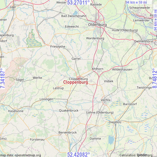
Cloppenburg GPS coordinates[2]
52° 50' 51.144" North, 8° 2' 42" East
| Map corner | latitude | longitude |
|---|---|---|
| Upper-left | 53.27011°, | 7.34187° |
| Center: | 52.84754°, | 8.045° |
| Lower-right: | 52.42082°, | 8.74812° |
| Map W x H: | 94.4×94.4 km | = 58.7×58.7mi |
| max Lat: | 55.01917° ⇑19.3% North |
| Cloppenburg: | 52.84754° |
| min Lat: | ⇓80.7% South 47.40724° |
| min Long | Cloppenburg | max Long |
| 5.92978° | 8.045° | 14.98853° |
| W 23.7%⇐ | ⇒76.3% E |
Elevation
Elevation of Cloppenburg is 42 m = 138 ft, and this is 207.1 m = 679 ft below average elevation for this country.
| Max E: |
1256 m = 4121 ft | 82% |
| Avg. | 249.1 m = 817 ft | |
| Cloppenburg | 42 m = 138 ft | |
Min E: |
-5 m = -16 ft | 18% |
See also: Germany elevation on elevation.city.
Geographical zone
Cloppenburg is located in North temperate zone (between Tropic of Cancer and the Arctic Circle). Distance of this North polar circle is 1525.1 km =947.7 mi to North.| Distance of | km | miles | from Cloppenburg |
|---|---|---|---|
| North Pole | 4131 | 2566.9 | to North |
| Arctic Circle | 1525.1 | 947.7 | to North |
| Tropic Cancer | 3270.2 | 2032 | to South |
| Equator | 5876.1 | 3651.2 | to South |


Nearby cities:
15 places around Cloppenburg: (largest is in red/bold)
• Bakum
15.6 km =9.7 mi,  139°
139°
• Bösel
18.1 km =11.2 mi,  339°
339°
• Bühren
12.5 km =7.8 mi,  111°
111°
• Cappeln
6.2 km =3.9 mi,  131°
131°
• Dinklage
21.3 km =13.2 mi,  165°
165°
• Emstek
7.2 km =4.5 mi,  102°
102°
• Essen
15.7 km =9.8 mi,  207°
207°
• Garrel
11.5 km =7.1 mi,  350°
350°
• Großenkneten
17.6 km =10.9 mi,  52°
52°
• Lastrup
13.3 km =8.3 mi,  243°
243°
• Molbergen
8.1 km =5 mi,  278°
278°
• Quakenbrück
20.2 km =12.6 mi,  198°
198°
• Vechta
21.1 km =13.1 mi, 129°
• Visbek
18.3 km =11.4 mi,  94°
94°
• Vrees
19.1 km =11.9 mi, 282°
Sources, notices
• [Note1] Compared only with cities in Germany existing in our database
• [Src1] Map data: © OpenStreetMap contributors (CC-BY-SA)
• [Src2] Other city data from geonames.org with taken over terms of usage.
• [Src3] Geographical zone / Annual Mean Temperature by Robert A. Rohde @ Wikipedia
