Breitscheid geodata
Breitscheid (Rheinland-Pfalz) is a seat of a fourth-order administrative division; located in Germany in Europe/Berlin (GMT+2) time zone. In our database, there are 11009 cities with bigger population. Compared to other cities in Germany, 51.1% of cities are located further ↑North; 88% of cities are located further →East and 66.1% of cities have lower elevation than Breitscheid. Note1
Administrative division(s):
- Level 1: Rheinland-Pfalz
- Level 3: Landkreis Neuwied
- Level 4: Breitscheid


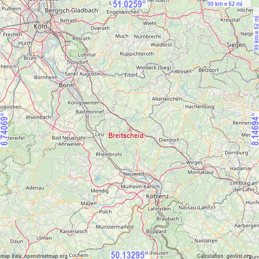
Breitscheid GPS coordinates[2]
50° 34' 53.544" North, 7° 26' 37.752" East
| Map corner | latitude | longitude |
|---|---|---|
| Upper-left | 51.0259°, | 6.74069° |
| Center: | 50.58154°, | 7.44382° |
| Lower-right: | 50.13295°, | 8.14694° |
| Map W x H: | 99.3×99.3 km | = 61.7×61.7mi |
| max Lat: | 55.01917° ⇑51.1% North |
| Breitscheid: | 50.58154° |
| min Lat: | ⇓48.9% South 47.40724° |
| min Long | Breitscheid | max Long |
| 5.92978° | 7.44382° | 14.98853° |
| W 12%⇐ | ⇒88% E |
Elevation
Elevation of Breitscheid is 329 m = 1079 ft, and this is 79.9 m = 262 ft above average elevation for this country.
| Max E: |
1256 m = 4121 ft | 33.9% |
| Breitscheid | 329 m 1079 ft | |
| Avg. | 249.1 m = 817 ft | |
Min E: |
-5 m = -16 ft | 66.1% |
See also: Germany elevation on elevation.city.
Geographical zone
Breitscheid is located in North temperate zone (between Tropic of Cancer and the Arctic Circle). Distance of this North polar circle is 1777 km =1104.2 mi to North.| Distance of | km | miles | from Breitscheid |
|---|---|---|---|
| North Pole | 4382.9 | 2723.4 | to North |
| Arctic Circle | 1777 | 1104.2 | to North |
| Tropic Cancer | 3018.2 | 1875.4 | to South |
| Equator | 5624.1 | 3494.7 | to South |


Nearby cities:
15 places around Breitscheid: (largest is in red/bold)
• Burglahr
5.5 km =3.4 mi,  42°
42°
• Bürdenbach
5.7 km =3.5 mi,  63°
63°
• Eulenberg
3.5 km =2.2 mi, 39°
• Hausen
5.1 km =3.2 mi,  210°
210°
• Horhausen
6.1 km =3.8 mi,  83°
83°
• Krunkel
4 km =2.5 mi,  87°
87°
• Kurtscheid
5.6 km =3.5 mi,  163°
163°
• Niederbreitbach
5.9 km =3.7 mi,  195°
195°
• Niedersteinebach
4.9 km =3 mi,  65°
65°
• Obersteinebach
2.8 km =1.7 mi, 85°
• Peterslahr
4.2 km =2.6 mi,  22°
22°
• Roßbach
2.1 km =1.3 mi,  249°
249°
• Sankt Katharinen
4.3 km =2.7 mi,  272°
272°
• Waldbreitbach
4 km =2.5 mi, 208°
• Willroth
6.1 km =3.8 mi,  103°
103°
Sources, notices
• [Note1] Compared only with cities in Germany existing in our database
• [Src1] Map data: © OpenStreetMap contributors (CC-BY-SA)
• [Src2] Other city data from geonames.org with taken over terms of usage.
• [Src3] Geographical zone / Annual Mean Temperature by Robert A. Rohde @ Wikipedia
