Sankt Katharinen geodata
Sankt Katharinen (Rheinland-Pfalz) is a populated place; located in Germany in Europe/Berlin (GMT+2) time zone. With population of 3,534 people, there are 3587 cities with bigger population in this country. Compared to other cities in Germany, 51% of cities are located further ↑North; 88.8% of cities are located further →East and 61.3% of cities have lower elevation than Sankt Katharinen. Note1
Administrative division(s):
- Level 1: Rheinland-Pfalz
- Level 3: Landkreis Neuwied
- Level 4: Sankt Katharinen (Landkreis Neuwied)


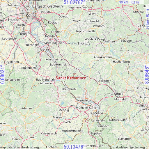
Sankt Katharinen GPS coordinates[2]
50° 34' 59.988" North, 7° 22' 59.988" East
| Map corner | latitude | longitude |
|---|---|---|
| Upper-left | 51.02767°, | 6.68021° |
| Center: | 50.58333°, | 7.38333° |
| Lower-right: | 50.13476°, | 8.08646° |
| Map W x H: | 99.3×99.3 km | = 61.7×61.7mi |
| max Lat: | 55.01917° ⇑51% North |
| Sankt Katharinen: | 50.58333° |
| min Lat: | ⇓49% South 47.40724° |
| min Long | Sankt Katharine | max Long |
| 5.92978° | 7.38333° | 14.98853° |
| W 11.2%⇐ | ⇒88.8% E |
Elevation
Elevation of Sankt Katharinen is 298 m = 978 ft, and this is 48.9 m = 160 ft above average elevation for this country.
| Max E: |
1256 m = 4121 ft | 38.7% |
| Sankt Katharinen | 298 m 978 ft | |
| Avg. | 249.1 m = 817 ft | |
Min E: |
-5 m = -16 ft | 61.3% |
See also: Germany elevation on elevation.city.
Geographical zone
Sankt Katharinen is located in North temperate zone (between Tropic of Cancer and the Arctic Circle). Distance of this North polar circle is 1776.8 km =1104.1 mi to North.| Distance of | km | miles | from Sankt Katharinen |
|---|---|---|---|
| North Pole | 4382.7 | 2723.3 | to North |
| Arctic Circle | 1776.8 | 1104.1 | to North |
| Tropic Cancer | 3018.4 | 1875.5 | to South |
| Equator | 5624.3 | 3494.8 | to South |


Nearby cities:
15 places around Sankt Katharinen: (largest is in red/bold)
• Breitscheid
4.3 km =2.7 mi,  92°
92°
• Dattenberg
7.1 km =4.4 mi,  242°
242°
• Eulenberg
7 km =4.3 mi,  68°
68°
• Hausen
4.8 km =3 mi,  159°
159°
• Kalenborn
6 km =3.7 mi,  306°
306°
• Leubsdorf
7 km =4.3 mi, 237°
• Linz am Rhein
7.2 km =4.5 mi,  257°
257°
• Niederbreitbach
6.4 km =4 mi, 155°
• Obersteinebach
7.1 km =4.4 mi, 90°
• Ockenfels
7.7 km =4.8 mi, 263°
• Peterslahr
7 km =4.3 mi,  57°
57°
• Roßbach
2.5 km =1.6 mi,  111°
111°
• Vettelschoß
4.4 km =2.7 mi,  327°
327°
• Waldbreitbach
4.4 km =2.7 mi,  147°
147°
• Windhagen
6.8 km =4.2 mi,  341°
341°
Sources, notices
• [Note1] Compared only with cities in Germany existing in our database
• [Src1] Map data: © OpenStreetMap contributors (CC-BY-SA)
• [Src2] Other city data from geonames.org with taken over terms of usage.
• [Src3] Geographical zone / Annual Mean Temperature by Robert A. Rohde @ Wikipedia
