Bösenbrunn geodata
Bösenbrunn (Saxony) is a seat of a fourth-order administrative division; located in Germany in Europe/Berlin (GMT+2) time zone. With population of 1,460 people, there are 5958 cities with bigger population in this country. Compared to other cities in Germany, 54.7% of cities are located further ↑North; 83.2% of cities are located further ←West and 79.5% of cities have lower elevation than Bösenbrunn. Note1


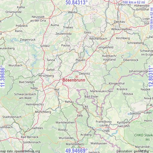
Bösenbrunn GPS coordinates[2]
50° 23' 49.308" North, 12° 5' 59.928" East
| Map corner | latitude | longitude |
|---|---|---|
| Upper-left | 50.84313°, | 11.39686° |
| Center: | 50.39703°, | 12.09998° |
| Lower-right: | 49.94669°, | 12.80311° |
| Map W x H: | 99.7×99.7 km | = 62×62mi |
| max Lat: | 55.01917° ⇑54.7% North |
| Bösenbrunn: | 50.39703° |
| min Lat: | ⇓45.3% South 47.40724° |
| min Long | Bösenbrunn | max Long |
| 5.92978° | 12.09998° | 14.98853° |
| W 83.2%⇐ | ⇒16.8% E |
Elevation
Elevation of Bösenbrunn is 430 m = 1411 ft, and this is 180.9 m = 594 ft above average elevation for this country.
| Max E: |
1256 m = 4121 ft | 20.5% |
| Bösenbrunn | 430 m 1411 ft | |
| Avg. | 249.1 m = 817 ft | |
Min E: |
-5 m = -16 ft | 79.5% |
See also: Germany elevation on elevation.city.
Geographical zone
Bösenbrunn is located in North temperate zone (between Tropic of Cancer and the Arctic Circle). Distance of this North polar circle is 1797.5 km =1116.9 mi to North.| Distance of | km | miles | from Bösenbrunn |
|---|---|---|---|
| North Pole | 4403.4 | 2736.1 | to North |
| Arctic Circle | 1797.5 | 1116.9 | to North |
| Tropic Cancer | 2997.7 | 1862.7 | to South |
| Equator | 5603.6 | 3481.9 | to South |


Nearby cities:
15 places around Bösenbrunn: (largest is in red/bold)
• Adorf
14.2 km =8.8 mi,  127°
127°
• Eichigt
7.1 km =4.4 mi,  137°
137°
• Feilitzsch
12.3 km =7.6 mi,  254°
254°
• Gattendorf
11 km =6.8 mi,  221°
221°
• Haag
10.5 km =6.5 mi,  189°
189°
• Neuensalz
14.1 km =8.8 mi,  35°
35°
• Oelsnitz
5.3 km =3.3 mi,  68°
68°
• Plauen
11.5 km =7.1 mi,  13°
13°
• Regnitzlosau
11.4 km =7.1 mi,  198°
198°
• Reuth
12.8 km =8 mi,  309°
309°
• Theuma
11.9 km =7.4 mi,  46°
46°
• Tirpersdorf
11.4 km =7.1 mi, 69°
• Triebel
3.2 km =2 mi,  152°
152°
• Trogen
11.2 km =7 mi, 252°
• Weischlitz
6.3 km =3.9 mi,  338°
338°
Sources, notices
• [Note1] Compared only with cities in Germany existing in our database
• [Src1] Map data: © OpenStreetMap contributors (CC-BY-SA)
• [Src2] Other city data from geonames.org with taken over terms of usage.
• [Src3] Geographical zone / Annual Mean Temperature by Robert A. Rohde @ Wikipedia
