Bergkirchen geodata
Bergkirchen (Bavaria) is a seat of a fourth-order administrative division; located in Germany in Europe/Berlin (GMT+2) time zone. With population of 6,955 people, there are 2196 cities with bigger population in this country. Compared to other cities in Germany, 91.8% of cities are located further ↑North; 72.2% of cities are located further ←West and 89.6% of cities have lower elevation than Bergkirchen. Note1
Administrative division(s):
- Level 1: Bavaria
- Level 2: Upper Bavaria
- Level 3: Landkreis Dachau
- Level 4: Bergkirchen


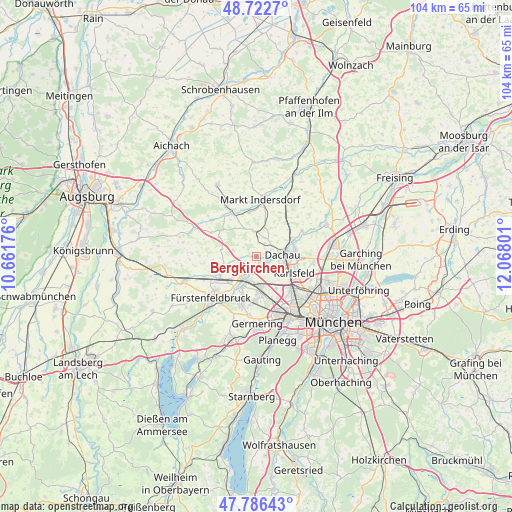
Bergkirchen GPS coordinates[2]
48° 15' 24.156" North, 11° 21' 53.568" East
| Map corner | latitude | longitude |
|---|---|---|
| Upper-left | 48.7227°, | 10.66176° |
| Center: | 48.25671°, | 11.36488° |
| Lower-right: | 47.78643°, | 12.06801° |
| Map W x H: | 104.1×104.1 km | = 64.7×64.7mi |
| max Lat: | 55.01917° ⇑91.8% North |
| Bergkirchen: | 48.25671° |
| min Lat: | ⇓8.2% South 47.40724° |
| min Long | Bergkirchen | max Long |
| 5.92978° | 11.36488° | 14.98853° |
| W 72.2%⇐ | ⇒27.8% E |
Elevation
Elevation of Bergkirchen is 509 m = 1670 ft, and this is 259.9 m = 853 ft above average elevation for this country.
| Max E: |
1256 m = 4121 ft | 10.4% |
| Bergkirchen | 509 m 1670 ft | |
| Avg. | 249.1 m = 817 ft | |
Min E: |
-5 m = -16 ft | 89.6% |
See also: Germany elevation on elevation.city.
Geographical zone
Bergkirchen is located in North temperate zone (between Tropic of Cancer and the Arctic Circle). Distance of this North polar circle is 2035.5 km =1264.8 mi to North.| Distance of | km | miles | from Bergkirchen |
|---|---|---|---|
| North Pole | 4641.4 | 2884 | to North |
| Arctic Circle | 2035.5 | 1264.8 | to North |
| Tropic Cancer | 2759.7 | 1714.8 | to South |
| Equator | 5365.6 | 3334 | to South |


Nearby cities:
15 places around Bergkirchen: (largest is in red/bold)
• Dachau
5.1 km =3.2 mi,  85°
85°
• Eichenau
10.6 km =6.6 mi,  199°
199°
• Emmering
10.2 km =6.3 mi,  216°
216°
• Erdweg
9.5 km =5.9 mi,  331°
331°
• Fürstenfeldbruck
11.9 km =7.4 mi, 223°
• Gröbenzell
6.3 km =3.9 mi,  178°
178°
• Hebertshausen
8.3 km =5.2 mi,  63°
63°
• Karlsfeld
8.8 km =5.5 mi,  111°
111°
• Maisach
8.5 km =5.3 mi,  238°
238°
• Markt Indersdorf
11.6 km =7.2 mi,  4°
4°
• Olching
6.7 km =4.2 mi, 200°
• Puchheim
11.9 km =7.4 mi,  185°
185°
• Röhrmoos
10.1 km =6.3 mi,  36°
36°
• Schwabhausen
5.2 km =3.2 mi,  352°
352°
• Sulzemoos
8.4 km =5.2 mi,  296°
296°
Sources, notices
• [Note1] Compared only with cities in Germany existing in our database
• [Src1] Map data: © OpenStreetMap contributors (CC-BY-SA)
• [Src2] Other city data from geonames.org with taken over terms of usage.
• [Src3] Geographical zone / Annual Mean Temperature by Robert A. Rohde @ Wikipedia
