Barßel geodata
Barßel (Lower Saxony) is a seat of a fourth-order administrative division; located in Germany in Europe/Berlin (GMT+2) time zone. With population of 12,475 people, there are 1304 cities with bigger population in this country. Compared to other cities in Germany, 82.7% of cities are located further ↓South; 82% of cities are located further →East and 98.1% of cities have higher elevation than Barßel. Note1


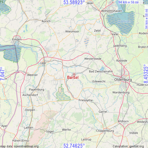
Barßel GPS coordinates[2]
53° 10' 11.316" North, 7° 45' 0.432" East
| Map corner | latitude | longitude |
|---|---|---|
| Upper-left | 53.58923°, | 7.047° |
| Center: | 53.16981°, | 7.75012° |
| Lower-right: | 52.74625°, | 8.45325° |
| Map W x H: | 93.7×93.7 km | = 58.2×58.2mi |
| max Lat: | 55.01917° ⇑17.3% North |
| Barßel: | 53.16981° |
| min Lat: | ⇓82.7% South 47.40724° |
| min Long | Barßel | max Long |
| 5.92978° | 7.75012° | 14.98853° |
| W 18%⇐ | ⇒82% E |
Elevation
Elevation of Barßel is 2 m = 7 ft, and this is 247.1 m = 811 ft below average elevation for this country.
| Max E: |
1256 m = 4121 ft | 98.1% |
| Avg. | 249.1 m = 817 ft | |
| Barßel | 2 m = 7 ft | |
Min E: |
-5 m = -16 ft | 1.9% |
See also: Germany elevation on elevation.city.
Geographical zone
Barßel is located in North temperate zone (between Tropic of Cancer and the Arctic Circle). Distance of this North polar circle is 1489.2 km =925.3 mi to North.| Distance of | km | miles | from Barßel |
|---|---|---|---|
| North Pole | 4095.1 | 2544.6 | to North |
| Arctic Circle | 1489.2 | 925.3 | to North |
| Tropic Cancer | 3306 | 2054.3 | to South |
| Equator | 5911.9 | 3673.5 | to South |


Nearby cities:
15 places around Barßel: (largest is in red/bold)
• Apen
6.2 km =3.9 mi,  32°
32°
• Bad Zwischenahn
16.7 km =10.4 mi,  84°
84°
• Bockhorst
19.2 km =11.9 mi,  217°
217°
• Brinkum
16.3 km =10.1 mi,  311°
311°
• Detern
6.7 km =4.2 mi, 310°
• Edewecht
16.3 km =10.1 mi,  106°
106°
• Filsum
11.4 km =7.1 mi, 314°
• Firrel
19 km =11.8 mi,  343°
343°
• Friesoythe
17.9 km =11.1 mi,  156°
156°
• Hesel
17.6 km =10.9 mi,  325°
325°
• Holtland
16.8 km =10.4 mi,  318°
318°
• Nortmoor
14.6 km =9.1 mi, 305°
• Ostrhauderfehn
9.8 km =6.1 mi,  245°
245°
• Schwerinsdorf
16.7 km =10.4 mi, 339°
• Westerstede
15.3 km =9.5 mi,  50°
50°
Sources, notices
• [Note1] Compared only with cities in Germany existing in our database
• [Src1] Map data: © OpenStreetMap contributors (CC-BY-SA)
• [Src2] Other city data from geonames.org with taken over terms of usage.
• [Src3] Geographical zone / Annual Mean Temperature by Robert A. Rohde @ Wikipedia
