Barnstorf geodata
Barnstorf (Lower Saxony) is a populated place; located in Germany in Europe/Berlin (GMT+2) time zone. With population of 6,050 people, there are 2445 cities with bigger population in this country. Compared to other cities in Germany, 79.7% of cities are located further ↓South; 71.1% of cities are located further →East and 85.8% of cities have higher elevation than Barnstorf. Note1
Administrative division(s):
- Level 1: Lower Saxony
- Level 3: Landkreis Diepholz
- Level 4: Barnstorf, Flecken


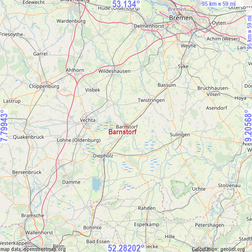
Barnstorf GPS coordinates[2]
52° 42' 36.324" North, 8° 30' 9.216" East
| Map corner | latitude | longitude |
|---|---|---|
| Upper-left | 53.134°, | 7.79943° |
| Center: | 52.71009°, | 8.50256° |
| Lower-right: | 52.28202°, | 9.20568° |
| Map W x H: | 94.7×94.7 km | = 58.8×58.8mi |
| max Lat: | 55.01917° ⇑20.3% North |
| Barnstorf: | 52.71009° |
| min Lat: | ⇓79.7% South 47.40724° |
| min Long | Barnstorf | max Long |
| 5.92978° | 8.50256° | 14.98853° |
| W 28.9%⇐ | ⇒71.1% E |
Elevation
Elevation of Barnstorf is 33 m = 108 ft, and this is 216.1 m = 709 ft below average elevation for this country.
| Max E: |
1256 m = 4121 ft | 85.8% |
| Avg. | 249.1 m = 817 ft | |
| Barnstorf | 33 m = 108 ft | |
Min E: |
-5 m = -16 ft | 14.2% |
See also: Germany elevation on elevation.city.
Geographical zone
Barnstorf is located in North temperate zone (between Tropic of Cancer and the Arctic Circle). Distance of this North polar circle is 1540.4 km =957.2 mi to North.| Distance of | km | miles | from Barnstorf |
|---|---|---|---|
| North Pole | 4146.2 | 2576.3 | to North |
| Arctic Circle | 1540.4 | 957.2 | to North |
| Tropic Cancer | 3254.9 | 2022.5 | to South |
| Equator | 5860.8 | 3641.7 | to South |


Nearby cities:
15 places around Barnstorf: (largest is in red/bold)
• Barver
11.6 km =7.2 mi,  148°
148°
• Colnrade
13.8 km =8.6 mi,  354°
354°
• Dickel
7.5 km =4.7 mi,  196°
196°
• Diepholz
14.5 km =9 mi,  218°
218°
• Drentwede
5.6 km =3.5 mi,  48°
48°
• Ehrenburg
14 km =8.7 mi,  71°
71°
• Eydelstedt
3.6 km =2.2 mi,  123°
123°
• Freistatt
14 km =8.7 mi,  133°
133°
• Goldenstedt
9.9 km =6.2 mi,  331°
331°
• Hemsloh
12.2 km =7.6 mi,  177°
177°
• Rehden
11.2 km =7 mi,  187°
187°
• Twistringen
13.6 km =8.5 mi,  43°
43°
• Vechta
14.7 km =9.1 mi,  277°
277°
• Wehrbleck
15.5 km =9.6 mi, 125°
• Wetschen
11.4 km =7.1 mi, 198°
Sources, notices
• [Note1] Compared only with cities in Germany existing in our database
• [Src1] Map data: © OpenStreetMap contributors (CC-BY-SA)
• [Src2] Other city data from geonames.org with taken over terms of usage.
• [Src3] Geographical zone / Annual Mean Temperature by Robert A. Rohde @ Wikipedia
