Alsfeld geodata
Alsfeld (Hesse) is a populated place; located in Germany in Europe/Berlin (GMT+2) time zone. With population of 17,771 people, there are 895 cities with bigger population in this country. Compared to other cities in Germany, 53.4% of cities are located further ↓South; 61.1% of cities are located further →East and 57.2% of cities have lower elevation than Alsfeld. Note1
Administrative division(s):
- Level 1: Hesse
- Level 2: Regierungsbezirk Gießen
- Level 3: Vogelsbergkreis
- Level 4: Alsfeld


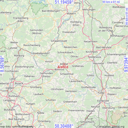
Alsfeld GPS coordinates[2]
50° 45' 6.66" North, 9° 16' 14.952" East
| Map corner | latitude | longitude |
|---|---|---|
| Upper-left | 51.19459°, | 8.56769° |
| Center: | 50.75185°, | 9.27082° |
| Lower-right: | 50.30488°, | 9.97394° |
| Map W x H: | 98.9×98.9 km | = 61.5×61.5mi |
| max Lat: | 55.01917° ⇑46.6% North |
| Alsfeld: | 50.75185° |
| min Lat: | ⇓53.4% South 47.40724° |
| min Long | Alsfeld | max Long |
| 5.92978° | 9.27082° | 14.98853° |
| W 38.9%⇐ | ⇒61.1% E |
Elevation
Elevation of Alsfeld is 273 m = 896 ft, and this is 23.9 m = 78 ft above average elevation for this country.
| Max E: |
1256 m = 4121 ft | 42.8% |
| Alsfeld | 273 m 896 ft | |
| Avg. | 249.1 m = 817 ft | |
Min E: |
-5 m = -16 ft | 57.2% |
See also: Germany elevation on elevation.city.
Geographical zone
Alsfeld is located in North temperate zone (between Tropic of Cancer and the Arctic Circle). Distance of this North polar circle is 1758.1 km =1092.4 mi to North.| Distance of | km | miles | from Alsfeld |
|---|---|---|---|
| North Pole | 4364 | 2711.7 | to North |
| Arctic Circle | 1758.1 | 1092.4 | to North |
| Tropic Cancer | 3037.2 | 1887.2 | to South |
| Equator | 5643.1 | 3506.5 | to South |


Nearby cities:
15 places around Alsfeld: (largest is in red/bold)
• Grebenau
14.3 km =8.9 mi,  94°
94°
• Homberg
19.4 km =12.1 mi,  263°
263°
• Kirtorf
11.9 km =7.4 mi,  279°
279°
• Lauterbach
15.7 km =9.8 mi,  145°
145°
• Lautertal
18.8 km =11.7 mi,  177°
177°
• Neukirchen
14.1 km =8.8 mi,  22°
22°
• Neustadt (Hessen)
15.4 km =9.6 mi,  315°
315°
• Oberaula
17.6 km =10.9 mi,  51°
51°
• Ottrau
10.1 km =6.3 mi, 53°
• Riebelsdorf
14.3 km =8.9 mi,  10°
10°
• Romrod
5.6 km =3.5 mi,  219°
219°
• Schrecksbach
9.1 km =5.7 mi, 5°
• Schwalmtal
8.5 km =5.3 mi,  206°
206°
• Seigertshausen
18.8 km =11.7 mi, 19°
• Willingshausen
12 km =7.5 mi,  335°
335°
Sources, notices
• [Note1] Compared only with cities in Germany existing in our database
• [Src1] Map data: © OpenStreetMap contributors (CC-BY-SA)
• [Src2] Other city data from geonames.org with taken over terms of usage.
• [Src3] Geographical zone / Annual Mean Temperature by Robert A. Rohde @ Wikipedia
