Albaching geodata
Albaching (Bavaria) is a seat of a fourth-order administrative division; located in Germany in Europe/Berlin (GMT+2) time zone. With population of 1,558 people, there are 5765 cities with bigger population in this country. Compared to other cities in Germany, 93.9% of cities are located further ↑North; 83.4% of cities are located further ←West and 89.8% of cities have lower elevation than Albaching. Note1
Administrative division(s):
- Level 1: Bavaria
- Level 2: Upper Bavaria
- Level 3: Landkreis Rosenheim
- Level 4: Albaching


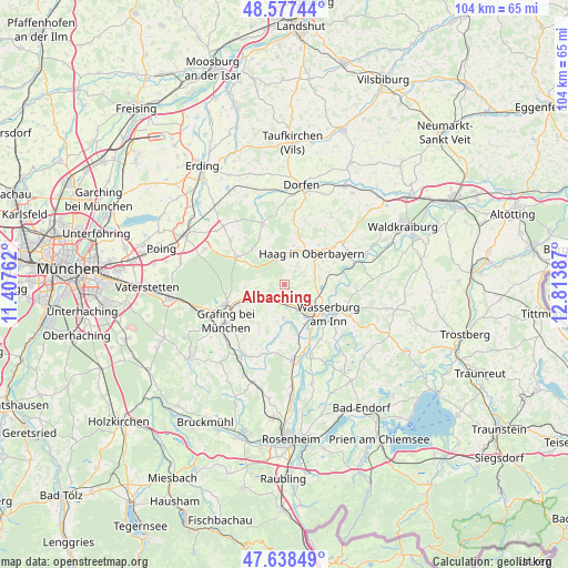
Albaching GPS coordinates[2]
48° 6' 36.396" North, 12° 6' 38.664" East
| Map corner | latitude | longitude |
|---|---|---|
| Upper-left | 48.57744°, | 11.40762° |
| Center: | 48.11011°, | 12.11074° |
| Lower-right: | 47.63849°, | 12.81387° |
| Map W x H: | 104.4×104.4 km | = 64.9×64.9mi |
| max Lat: | 55.01917° ⇑93.9% North |
| Albaching: | 48.11011° |
| min Lat: | ⇓6.1% South 47.40724° |
| min Long | Albaching | max Long |
| 5.92978° | 12.11074° | 14.98853° |
| W 83.4%⇐ | ⇒16.6% E |
Elevation
Elevation of Albaching is 512 m = 1680 ft, and this is 262.9 m = 863 ft above average elevation for this country.
| Max E: |
1256 m = 4121 ft | 10.2% |
| Albaching | 512 m 1680 ft | |
| Avg. | 249.1 m = 817 ft | |
Min E: |
-5 m = -16 ft | 89.8% |
See also: Germany elevation on elevation.city.
Geographical zone
Albaching is located in North temperate zone (between Tropic of Cancer and the Arctic Circle). Distance of this North polar circle is 2051.8 km =1274.9 mi to North.| Distance of | km | miles | from Albaching |
|---|---|---|---|
| North Pole | 4657.7 | 2894.2 | to North |
| Arctic Circle | 2051.8 | 1274.9 | to North |
| Tropic Cancer | 2743.4 | 1704.7 | to South |
| Equator | 5349.3 | 3323.9 | to South |


Nearby cities:
15 places around Albaching: (largest is in red/bold)
• Altdorf
7.3 km =4.5 mi,  48°
48°
• Breitbrunn
8.1 km =5 mi,  156°
156°
• Ebersberg
11 km =6.8 mi,  250°
250°
• Edling
7.2 km =4.5 mi,  146°
146°
• Fraueneuharting
9.2 km =5.7 mi,  210°
210°
• Haag in Oberbayern
7.7 km =4.8 mi,  41°
41°
• Hohenlinden
10 km =6.2 mi,  300°
300°
• Kirchdorf
9.7 km =6 mi, 41°
• Maitenbeth
4.7 km =2.9 mi,  343°
343°
• Pfaffing
6.2 km =3.9 mi,  181°
181°
• Ramerberg
10.5 km =6.5 mi,  165°
165°
• Rechtmehring
4.2 km =2.6 mi,  80°
80°
• Soyen
7.4 km =4.6 mi,  91°
91°
• Steinhöring
6.4 km =4 mi, 246°
• Wasserburg am Inn
10.5 km =6.5 mi,  127°
127°
Sources, notices
• [Note1] Compared only with cities in Germany existing in our database
• [Src1] Map data: © OpenStreetMap contributors (CC-BY-SA)
• [Src2] Other city data from geonames.org with taken over terms of usage.
• [Src3] Geographical zone / Annual Mean Temperature by Robert A. Rohde @ Wikipedia
