Ahausen geodata
Ahausen (Lower Saxony) is a seat of a fourth-order administrative division; located in Germany in Europe/Berlin (GMT+2) time zone. With population of 1,769 people, there are 5399 cities with bigger population in this country. Compared to other cities in Germany, 82.1% of cities are located further ↓South; 60.6% of cities are located further →East and 91.6% of cities have higher elevation than Ahausen. Note1


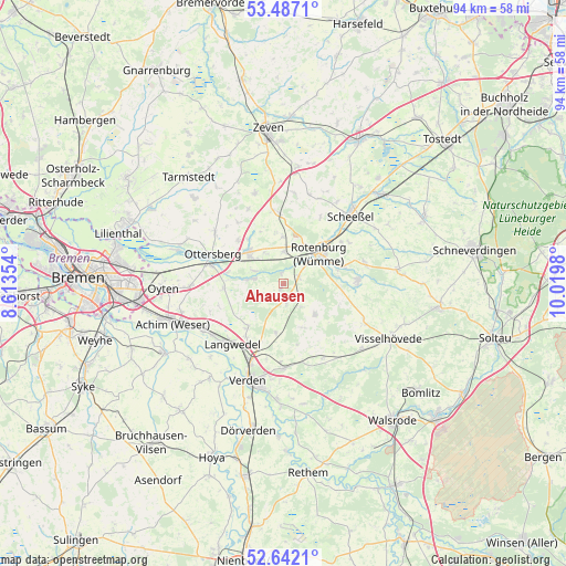
Ahausen GPS coordinates[2]
53° 4' 0.012" North, 9° 19' 0.012" East
| Map corner | latitude | longitude |
|---|---|---|
| Upper-left | 53.4871°, | 8.61354° |
| Center: | 53.06667°, | 9.31667° |
| Lower-right: | 52.6421°, | 10.0198° |
| Map W x H: | 94×94 km | = 58.4×58.4mi |
| max Lat: | 55.01917° ⇑17.9% North |
| Ahausen: | 53.06667° |
| min Lat: | ⇓82.1% South 47.40724° |
| min Long | Ahausen | max Long |
| 5.92978° | 9.31667° | 14.98853° |
| W 39.4%⇐ | ⇒60.6% E |
Elevation
Elevation of Ahausen is 17 m = 56 ft, and this is 232.1 m = 761 ft below average elevation for this country.
| Max E: |
1256 m = 4121 ft | 91.6% |
| Avg. | 249.1 m = 817 ft | |
| Ahausen | 17 m = 56 ft | |
Min E: |
-5 m = -16 ft | 8.4% |
See also: Germany elevation on elevation.city.
Geographical zone
Ahausen is located in North temperate zone (between Tropic of Cancer and the Arctic Circle). Distance of this North polar circle is 1500.7 km =932.5 mi to North.| Distance of | km | miles | from Ahausen |
|---|---|---|---|
| North Pole | 4106.6 | 2551.7 | to North |
| Arctic Circle | 1500.7 | 932.5 | to North |
| Tropic Cancer | 3294.5 | 2047.1 | to South |
| Equator | 5900.5 | 3666.4 | to South |


Nearby cities:
15 places around Ahausen: (largest is in red/bold)
• Bothel
12.2 km =7.6 mi,  90°
90°
• Brockel
13.9 km =8.6 mi,  74°
74°
• Bötersen
7.4 km =4.6 mi,  0°
0°
• Hassendorf
5.8 km =3.6 mi,  323°
323°
• Hellwege
5.5 km =3.4 mi,  277°
277°
• Hemsbünde
10.7 km =6.6 mi,  76°
76°
• Kirchlinteln
13.8 km =8.6 mi,  179°
179°
• Kirchwalsede
7.9 km =4.9 mi,  134°
134°
• Langwedel
13.1 km =8.1 mi,  221°
221°
• Ottersberg
12.5 km =7.8 mi,  292°
292°
• Reeßum
10 km =6.2 mi, 317°
• Rotenburg
8 km =5 mi,  51°
51°
• Scharnhorst
12.9 km =8 mi,  192°
192°
• Sottrum
7.9 km =4.9 mi,  314°
314°
• Westerwalsede
5 km =3.1 mi,  137°
137°
Sources, notices
• [Note1] Compared only with cities in Germany existing in our database
• [Src1] Map data: © OpenStreetMap contributors (CC-BY-SA)
• [Src2] Other city data from geonames.org with taken over terms of usage.
• [Src3] Geographical zone / Annual Mean Temperature by Robert A. Rohde @ Wikipedia
