Oberrotweil geodata
Oberrotweil (Baden-Württemberg) is a populated place; located in Germany in Europe/Berlin (GMT+2) time zone. With population of 1,600 people, there are 5683 cities with bigger population in this country. Compared to other cities in Germany, 94.2% of cities are located further ↑North; 84.1% of cities are located further →East and 51.5% of cities have higher elevation than Oberrotweil. Note1
Administrative division(s):
- Level 1: Baden-Württemberg
- Level 2: Freiburg Region
- Level 3: Landkreis Breisgau-Hochschwarzwald
- Level 4: Vogtsburg im Kaiserstuhl


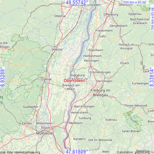
Oberrotweil GPS coordinates[2]
48° 5' 23.64" North, 7° 38' 9.636" East
| Map corner | latitude | longitude |
|---|---|---|
| Upper-left | 48.55742°, | 6.93289° |
| Center: | 48.0899°, | 7.63601° |
| Lower-right: | 47.61809°, | 8.33914° |
| Map W x H: | 104.4×104.4 km | = 64.9×64.9mi |
| max Lat: | 55.01917° ⇑94.2% North |
| Oberrotweil: | 48.0899° |
| min Lat: | ⇓5.8% South 47.40724° |
| min Long | Oberrotweil | max Long |
| 5.92978° | 7.63601° | 14.98853° |
| W 15.9%⇐ | ⇒84.1% E |
Elevation
Elevation of Oberrotweil is 215 m = 705 ft, and this is 34.1 m = 112 ft below average elevation for this country.
| Max E: |
1256 m = 4121 ft | 51.5% |
| Avg. | 249.1 m = 817 ft | |
| Oberrotweil | 215 m = 705 ft | |
Min E: |
-5 m = -16 ft | 48.5% |
See also: Germany elevation on elevation.city.
Geographical zone
Oberrotweil is located in North temperate zone (between Tropic of Cancer and the Arctic Circle). Distance of this North polar circle is 2054.1 km =1276.4 mi to North.| Distance of | km | miles | from Oberrotweil |
|---|---|---|---|
| North Pole | 4660 | 2895.6 | to North |
| Arctic Circle | 2054.1 | 1276.4 | to North |
| Tropic Cancer | 2741.2 | 1703.3 | to South |
| Equator | 5347.1 | 3322.5 | to South |


Nearby cities:
15 places around Oberrotweil: (largest is in red/bold)
• Bahlingen
8.4 km =5.2 mi,  66°
66°
• Bischoffingen
1.7 km =1.1 mi,  337°
337°
• Breisach am Rhein
7.5 km =4.7 mi,  211°
211°
• Buchheim
10.7 km =6.6 mi,  108°
108°
• Bötzingen
6.8 km =4.2 mi,  102°
102°
• Eichstetten
7.9 km =4.9 mi,  86°
86°
• Endingen
7.5 km =4.7 mi,  39°
39°
• Forchheim
9.8 km =6.1 mi,  29°
29°
• Gottenheim
8.5 km =5.3 mi,  121°
121°
• Ihringen
5.3 km =3.3 mi,  170°
170°
• Merdingen
8.9 km =5.5 mi,  156°
156°
• Riegel
10.8 km =6.7 mi,  50°
50°
• Sasbach
5.6 km =3.5 mi, 344°
• Vogtsburg
0.9 km =0.6 mi, 29°
• Wyhl
8.5 km =5.3 mi,  6°
6°
Sources, notices
• [Note1] Compared only with cities in Germany existing in our database
• [Src1] Map data: © OpenStreetMap contributors (CC-BY-SA)
• [Src2] Other city data from geonames.org with taken over terms of usage.
• [Src3] Geographical zone / Annual Mean Temperature by Robert A. Rohde @ Wikipedia
