Gottenheim geodata
Gottenheim (Baden-Württemberg) is a seat of a fourth-order administrative division; located in Germany in Europe/Berlin (GMT+2) time zone. With population of 2,456 people, there are 4495 cities with bigger population in this country. Compared to other cities in Germany, 94.9% of cities are located further ↑North; 82.5% of cities are located further →East and 54.7% of cities have higher elevation than Gottenheim. Note1
Administrative division(s):
- Level 1: Baden-Württemberg
- Level 2: Freiburg Region
- Level 3: Landkreis Breisgau-Hochschwarzwald
- Level 4: Gottenheim


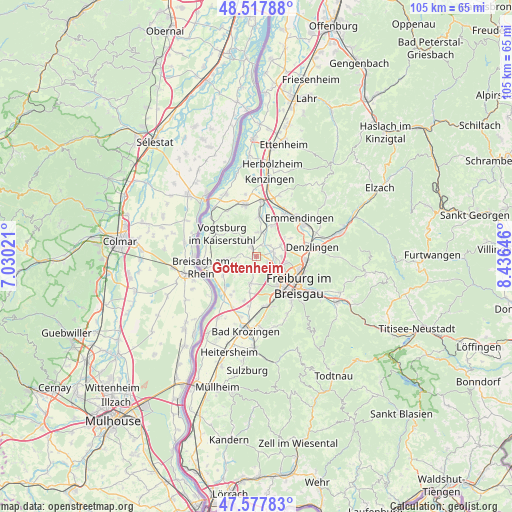
Gottenheim GPS coordinates[2]
48° 3' 0" North, 7° 43' 59.988" East
| Map corner | latitude | longitude |
|---|---|---|
| Upper-left | 48.51788°, | 7.03021° |
| Center: | 48.05°, | 7.73333° |
| Lower-right: | 47.57783°, | 8.43646° |
| Map W x H: | 104.5×104.5 km | = 64.9×64.9mi |
| max Lat: | 55.01917° ⇑94.9% North |
| Gottenheim: | 48.05° |
| min Lat: | ⇓5.1% South 47.40724° |
| min Long | Gottenheim | max Long |
| 5.92978° | 7.73333° | 14.98853° |
| W 17.5%⇐ | ⇒82.5% E |
Elevation
Elevation of Gottenheim is 191 m = 627 ft, and this is 58.1 m = 191 ft below average elevation for this country.
| Max E: |
1256 m = 4121 ft | 54.7% |
| Avg. | 249.1 m = 817 ft | |
| Gottenheim | 191 m = 627 ft | |
Min E: |
-5 m = -16 ft | 45.3% |
See also: Germany elevation on elevation.city.
Geographical zone
Gottenheim is located in North temperate zone (between Tropic of Cancer and the Arctic Circle). Distance of this North polar circle is 2058.5 km =1279.1 mi to North.| Distance of | km | miles | from Gottenheim |
|---|---|---|---|
| North Pole | 4664.4 | 2898.3 | to North |
| Arctic Circle | 2058.5 | 1279.1 | to North |
| Tropic Cancer | 2736.7 | 1700.5 | to South |
| Equator | 5342.7 | 3319.8 | to South |


Nearby cities:
15 places around Gottenheim: (largest is in red/bold)
• Bahlingen
7.9 km =4.9 mi,  3°
3°
• Bischoffingen
9.9 km =6.2 mi,  307°
307°
• Buchheim
3.1 km =1.9 mi,  70°
70°
• Bötzingen
3 km =1.9 mi,  347°
347°
• Eichstetten
5 km =3.1 mi,  7°
7°
• Endingen
10.5 km =6.5 mi, 346°
• Gundelfingen
9.9 km =6.2 mi,  94°
94°
• Ihringen
6.4 km =4 mi,  263°
263°
• Merdingen
5.2 km =3.2 mi,  225°
225°
• Oberrotweil
8.5 km =5.3 mi,  301°
301°
• Schallstadt
10.3 km =6.4 mi,  169°
169°
• Teningen
10.6 km =6.6 mi,  33°
33°
• Umkirch
3.1 km =1.9 mi,  126°
126°
• Vogtsburg
8.6 km =5.3 mi, 307°
• Vörstetten
8.9 km =5.5 mi,  77°
77°
Sources, notices
• [Note1] Compared only with cities in Germany existing in our database
• [Src1] Map data: © OpenStreetMap contributors (CC-BY-SA)
• [Src2] Other city data from geonames.org with taken over terms of usage.
• [Src3] Geographical zone / Annual Mean Temperature by Robert A. Rohde @ Wikipedia
