Ransbach-Baumbach geodata
Ransbach-Baumbach (Rheinland-Pfalz) is a populated place; located in Germany in Europe/Berlin (GMT+2) time zone. With population of 7,327 people, there are 2107 cities with bigger population in this country. Compared to other cities in Germany, 53.5% of cities are located further ↑North; 82.5% of cities are located further →East and 62.5% of cities have lower elevation than Ransbach-Baumbach. Note1
Administrative division(s):
- Level 1: Rheinland-Pfalz
- Level 3: Westerwaldkreis
- Level 4: Ransbach-Baumbach


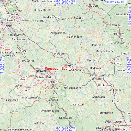
Ransbach-Baumbach GPS coordinates[2]
50° 27' 53.856" North, 7° 43' 41.88" East
| Map corner | latitude | longitude |
|---|---|---|
| Upper-left | 50.91042°, | 7.02517° |
| Center: | 50.46496°, | 7.7283° |
| Lower-right: | 50.01527°, | 8.43142° |
| Map W x H: | 99.5×99.5 km | = 61.8×61.8mi |
| max Lat: | 55.01917° ⇑53.5% North |
| Ransbach-Baumbach: | 50.46496° |
| min Lat: | ⇓46.5% South 47.40724° |
| min Long | Ransbach-Baumba | max Long |
| 5.92978° | 7.7283° | 14.98853° |
| W 17.5%⇐ | ⇒82.5% E |
Elevation
Elevation of Ransbach-Baumbach is 305 m = 1001 ft, and this is 55.9 m = 183 ft above average elevation for this country.
| Max E: |
1256 m = 4121 ft | 37.5% |
| Ransbach-Baumbach | 305 m 1001 ft | |
| Avg. | 249.1 m = 817 ft | |
Min E: |
-5 m = -16 ft | 62.5% |
See also: Germany elevation on elevation.city.
Geographical zone
Ransbach-Baumbach is located in North temperate zone (between Tropic of Cancer and the Arctic Circle). Distance of this North polar circle is 1790 km =1112.3 mi to North.| Distance of | km | miles | from Ransbach-Baumbach |
|---|---|---|---|
| North Pole | 4395.9 | 2731.5 | to North |
| Arctic Circle | 1790 | 1112.3 | to North |
| Tropic Cancer | 3005.3 | 1867.4 | to South |
| Equator | 5611.2 | 3486.6 | to South |


Nearby cities:
15 places around Ransbach-Baumbach: (largest is in red/bold)
• Alsbach
4.7 km =2.9 mi,  268°
268°
• Breitenau
4.5 km =2.8 mi,  324°
324°
• Deesen
5.5 km =3.4 mi,  338°
338°
• Dernbach
4.5 km =2.8 mi,  103°
103°
• Ebernhahn
3.1 km =1.9 mi,  73°
73°
• Ellenhausen
5.7 km =3.5 mi,  357°
357°
• Hilgert
3.1 km =1.9 mi,  251°
251°
• Hundsdorf
1.9 km =1.2 mi,  287°
287°
• Höhr-Grenzhausen
5.4 km =3.4 mi,  231°
231°
• Kammerforst
3.7 km =2.3 mi, 266°
• Mogendorf
4 km =2.5 mi,  34°
34°
• Siershahn
4.3 km =2.7 mi,  56°
56°
• Wirges
5 km =3.1 mi,  81°
81°
• Wirscheid
4.4 km =2.7 mi, 272°
• Wittgert
4.4 km =2.7 mi,  332°
332°
Sources, notices
• [Note1] Compared only with cities in Germany existing in our database
• [Src1] Map data: © OpenStreetMap contributors (CC-BY-SA)
• [Src2] Other city data from geonames.org with taken over terms of usage.
• [Src3] Geographical zone / Annual Mean Temperature by Robert A. Rohde @ Wikipedia
