Burg Unter-Falkenstein geodata
Burg Unter-Falkenstein (Bavaria) is a seat of government of a political entity; located in Germany in Europe/Berlin (GMT+2) time zone. In our database, there are 11009 cities with bigger population. Compared to other cities in Germany, 98.7% of cities are located further ↑North; 83.3% of cities are located further ←West and 100% of cities have lower elevation than Burg Unter-Falkenstein. Note1
Administrative division(s):
- Level 1: Bavaria
- Level 2: Upper Bavaria
- Level 3: Landkreis Rosenheim
- Level 4: Flintsbach a.Inn
Current local time in Burg Unter-Falkenstein:
05:12 PM, TuesdayDifference from your time zone: hours


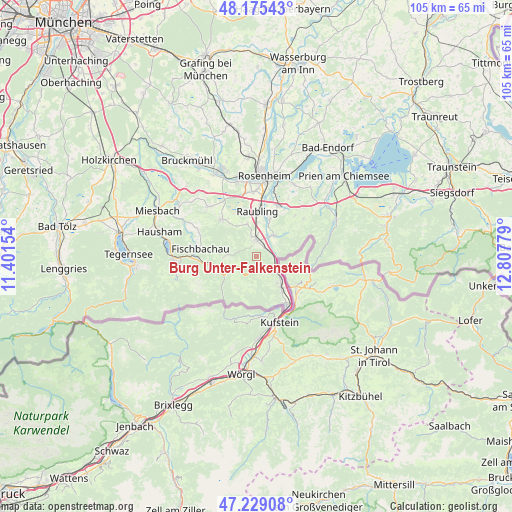
Burg Unter-Falkenstein GPS coordinates[2]
47° 42' 15.84" North, 12° 6' 16.776" East
| Map corner | latitude | longitude |
|---|---|---|
| Upper-left | 48.17543°, | 11.40154° |
| Center: | 47.7044°, | 12.10466° |
| Lower-right: | 47.22908°, | 12.80779° |
| Map W x H: | 105.2×105.2 km | = 65.4×65.4mi |
| max Lat: | 55.01917° ⇑98.7% North |
| Burg Unter-Falkenstein: | 47.7044° |
| min Lat: | ⇓1.3% South 47.40724° |
| min Long | Burg Unter-Falk | max Long |
| 5.92978° | 12.10466° | 14.98853° |
| W 83.3%⇐ | ⇒16.7% E |
Elevation
Elevation of Burg Unter-Falkenstein is 1256 m = 4121 ft, and this is 1006.9 m = 3303 ft above average elevation for this country.
| Max E: |
1256 m = 4121 ft | 0% |
| Burg Unter-Falkenstein | 1256 m 4121 ft | |
| Avg. | 249.1 m = 817 ft | |
Min E: |
-5 m = -16 ft | 100% |
See also: Germany elevation on elevation.city.
Geographical zone
Burg Unter-Falkenstein is located in North temperate zone (between Tropic of Cancer and the Arctic Circle). Distance of this North polar circle is 2096.9 km =1303 mi to North.| Distance of | km | miles | from Burg Unter-Falkenstein |
|---|---|---|---|
| North Pole | 4702.8 | 2922.2 | to North |
| Arctic Circle | 2096.9 | 1303 | to North |
| Tropic Cancer | 2698.3 | 1676.6 | to South |
| Equator | 5304.2 | 3295.9 | to South |


Nearby cities:
15 places around Burg Unter-Falkenstein: (largest is in red/bold)
• Altenmarkt
8.7 km =5.4 mi,  15°
15°
• Bad Feilnbach
10.4 km =6.5 mi,  317°
317°
• Bayrischzell
7.5 km =4.7 mi,  243°
243°
• Brannenburg
4.1 km =2.5 mi,  346°
346°
• Fischbachau
11.6 km =7.2 mi,  278°
278°
• Flintsbach
2.8 km =1.7 mi,  31°
31°
• Kiefersfelden
11.9 km =7.4 mi,  147°
147°
• Kolbermoor
16.4 km =10.2 mi, 350°
• Neubeuern
8.1 km =5 mi, 18°
• Nußdorf am Inn
5.7 km =3.5 mi,  42°
42°
• Oberaudorf
8 km =5 mi,  140°
140°
• Raubling
9.6 km =6 mi,  2°
2°
• Riedering
16.8 km =10.4 mi, 27°
• Rohrdorf
11.4 km =7.1 mi, 25°
• Samerberg
10.3 km =6.4 mi, 38°
Sources, notices
• [Note1] Compared only with cities in Germany existing in our database
• [Src1] Map data: © OpenStreetMap contributors (CC-BY-SA)
• [Src2] Other city data from geonames.org with taken over terms of usage.
• [Src3] Geographical zone / Annual Mean Temperature by Robert A. Rohde @ Wikipedia
