Chabelley geodata
Chabelley (Ali Sabieh) is a populated place; located in Djibouti in Africa/Djibouti (GMT+3) time zone. With population of 720 people, there are 12 cities with bigger population in this country. Compared to other cities in Djibouti, 58.3% of cities are located further ↑North; 75% of cities are located further ←West and 66.7% of cities have higher elevation than Chabelley. Note1


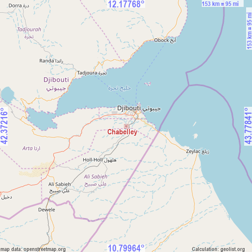
Chabelley GPS coordinates[2]
11° 29' 22.2" North, 43° 4' 31.008" East
| Map corner | latitude | longitude |
|---|---|---|
| Upper-left | 12.17768°, | 42.37216° |
| Center: | 11.4895°, | 43.07528° |
| Lower-right: | 10.79964°, | 43.77841° |
| Map W x H: | 153.2×153.2 km | = 95.2×95.2mi |
| max Lat: | 12.42167° ⇑58.3% North |
| Chabelley: | 11.4895° |
| min Lat: | ⇓41.7% South 11.10454° |
| min Long | Chabelley | max Long |
| 41.83611° | 43.07528° | 43.28835° |
| W 75%⇐ | ⇒25% E |
Elevation
Elevation of Chabelley is 85 m = 279 ft, and this is 191.8 m = 629 ft below average elevation for this country.
| Max E: |
706 m = 2316 ft | 66.7% |
| Avg. | 276.8 m = 908 ft | |
| Chabelley | 85 m = 279 ft | |
Min E: |
6 m = 20 ft | 33.3% |
See also: Djibouti elevation on elevation.city.
Geographical zone
Chabelley is located in North Torrid zone (between Equator and Tropic of Cancer). Distance of Equator is 1277.5 km =793.8 mi to South.| Distance of | km | miles | from Chabelley |
|---|---|---|---|
| North Pole | 8729.5 | 5424.3 | to North |
| Arctic Circle | 6123.7 | 3805.1 | to North |
| Tropic Cancer | 1328.4 | 825.4 | to North |
| Equator | 1277.5 | 793.8 | to South |


Nearby cities:
12 places around Chabelley: (largest is in red/bold)
• 'Ali Sabieh
54.2 km =33.7 mi,  226°
226°
• Alaïli Ḏaḏḏa‘
105.5 km =65.6 mi,  349°
349°
• Arta
24.7 km =15.3 mi,  279°
279°
• Dikhil
88 km =54.7 mi,  240°
240°
• Djibouti
13.4 km =8.3 mi,  34°
34°
• Dorra
98.2 km =61 mi,  318°
318°
• Goubétto
11 km =6.8 mi, 228°
• Gâlâfi
137.3 km =85.3 mi, 280°
• Holhol
25.5 km =15.8 mi,  218°
218°
• Loyada
19.6 km =12.2 mi,  99°
99°
• Obock
57.9 km =36 mi,  23°
23°
• Tadjourah
39.3 km =24.4 mi,  327°
327°
Sources, notices
• [Note1] Compared only with cities in Djibouti existing in our database
• [Src1] Map data: © OpenStreetMap contributors (CC-BY-SA)
• [Src2] Other city data from geonames.org with taken over terms of usage.
• [Src3] Geographical zone / Annual Mean Temperature by Robert A. Rohde @ Wikipedia
