Villa Riva geodata
Villa Riva (Duarte) is a populated place; located in Dominican Republic in America/Santo_Domingo (GMT-4) time zone. With population of 5,700 people, there are 101 cities with bigger population in this country. Compared to other cities in Dominican Republic, 61.6% of cities are located further ↓South; 79.6% of cities are located further ←West and 76.8% of cities have higher elevation than Villa Riva. Note1
Administrative division(s):
- Level 1: Duarte
- Level 2: Villa Riva
- Level 3: Villa Riva
- Level 4: Villa Riva (Zona Urbana)


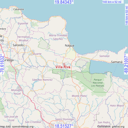
Villa Riva GPS coordinates[2]
19° 10' 50.484" North, 69° 54' 47.484" West
| Map corner | latitude | longitude |
|---|---|---|
| Upper-left | 19.84343°, | -70.61632° |
| Center: | 19.18069°, | -69.91319° |
| Lower-right: | 18.51527°, | -69.21007° |
| Map W x H: | 147.7×147.7 km | = 91.8×91.8mi |
| max Lat: | 19.89131° ⇑38.4% North |
| Villa Riva: | 19.18069° |
| min Lat: | ⇓61.6% South 17.80136° |
| min Long | Villa Riva | max Long |
| -71.85022° | -69.91319° | -68.40431° |
| W 79.6%⇐ | ⇒20.4% E |
Elevation
Elevation of Villa Riva is 29 m = 95 ft, and this is 137.3 m = 450 ft below average elevation for this country.
| Max E: |
1242 m = 4075 ft | 76.8% |
| Avg. | 166.3 m = 546 ft | |
| Villa Riva | 29 m = 95 ft | |
Min E: |
5 m = 16 ft | 23.2% |
See also: Dominican Republic elevation on elevation.city.
Geographical zone
Villa Riva is located in North Torrid zone (between Equator and Tropic of Cancer). Distance of this Northern Tropic circle is 473.2 km =294 mi to North.| Distance of | km | miles | from Villa Riva |
|---|---|---|---|
| North Pole | 7874.4 | 4892.9 | to North |
| Arctic Circle | 5268.5 | 3273.7 | to North |
| Tropic Cancer | 473.2 | 294 | to North |
| Equator | 2132.7 | 1325.2 | to South |


Nearby cities:
15 places around Villa Riva: (largest is in red/bold)
• Agua Santa del Yuna
12.3 km =7.6 mi,  105°
105°
• Arenoso
5.7 km =3.5 mi,  82°
82°
• Castillo
12.4 km =7.7 mi,  284°
284°
• Cevicos
20.8 km =12.9 mi,  199°
199°
• Cotuí
28.6 km =17.8 mi,  240°
240°
• El Factor
15.5 km =9.6 mi,  9°
9°
• Gonzalo
30.7 km =19.1 mi,  146°
146°
• Hostos
11.3 km =7 mi,  269°
269°
• La Peña
29.2 km =18.1 mi,  291°
291°
• Las Guáranas
31 km =19.3 mi, 272°
• Majagual
17.5 km =10.9 mi, 152°
• Nagua
23.6 km =14.7 mi,  17°
17°
• Pimentel
20.6 km =12.8 mi, 271°
• Sabana Grande de Boyá
29.1 km =18.1 mi, 154°
• Sánchez
31.9 km =19.8 mi, 80°
Sources, notices
• [Note1] Compared only with cities in Dominican Republic existing in our database
• [Src1] Map data: © OpenStreetMap contributors (CC-BY-SA)
• [Src2] Other city data from geonames.org with taken over terms of usage.
• [Src3] Geographical zone / Annual Mean Temperature by Robert A. Rohde @ Wikipedia
