El Factor geodata
El Factor (María Trinidad Sánchez) is a populated place; located in Dominican Republic in America/Santo_Domingo (GMT-4) time zone. With population of 7,014 people, there are 84 cities with bigger population in this country. Compared to other cities in Dominican Republic, 69.7% of cities are located further ↓South; 84.4% of cities are located further ←West and 83.4% of cities have higher elevation than El Factor. Note1
Administrative division(s):
- Level 1: María Trinidad Sánchez
- Level 2: El Factor
- Level 3: El Factor
- Level 4: El Factor (Zona Urbana)


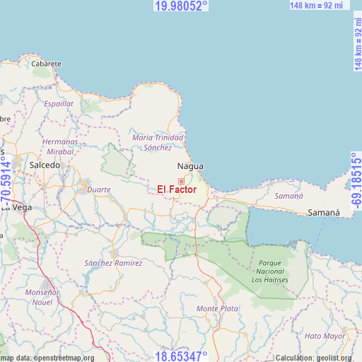
El Factor GPS coordinates[2]
19° 19' 6.024" North, 69° 53' 17.772" West
| Map corner | latitude | longitude |
|---|---|---|
| Upper-left | 19.98052°, | -70.5914° |
| Center: | 19.31834°, | -69.88827° |
| Lower-right: | 18.65347°, | -69.18515° |
| Map W x H: | 147.6×147.6 km | = 91.7×91.7mi |
| max Lat: | 19.89131° ⇑30.3% North |
| El Factor: | 19.31834° |
| min Lat: | ⇓69.7% South 17.80136° |
| min Long | El Factor | max Long |
| -71.85022° | -69.88827° | -68.40431° |
| W 84.4%⇐ | ⇒15.6% E |
Elevation
Elevation of El Factor is 20 m = 66 ft, and this is 146.3 m = 480 ft below average elevation for this country.
| Max E: |
1242 m = 4075 ft | 83.4% |
| Avg. | 166.3 m = 546 ft | |
| El Factor | 20 m = 66 ft | |
Min E: |
5 m = 16 ft | 16.6% |
See also: Dominican Republic elevation on elevation.city.
Geographical zone
El Factor is located in North Torrid zone (between Equator and Tropic of Cancer). Distance of this Northern Tropic circle is 457.9 km =284.5 mi to North.| Distance of | km | miles | from El Factor |
|---|---|---|---|
| North Pole | 7859.1 | 4883.4 | to North |
| Arctic Circle | 5253.2 | 3264.2 | to North |
| Tropic Cancer | 457.9 | 284.5 | to North |
| Equator | 2148 | 1334.7 | to South |


Nearby cities:
15 places around El Factor: (largest is in red/bold)
• Agua Santa del Yuna
20.8 km =12.9 mi,  153°
153°
• Arenoso
14.9 km =9.3 mi,  168°
168°
• Arroyo Salado
20.2 km =12.6 mi,  356°
356°
• Cabrera
36.1 km =22.4 mi, 357°
• Castillo
19 km =11.8 mi,  229°
229°
• Cevicos
36.2 km =22.5 mi,  195°
195°
• Hostos
20.7 km =12.9 mi,  222°
222°
• La Entrada
26.2 km =16.3 mi, 355°
• La Peña
30.1 km =18.7 mi,  261°
261°
• Las Terrenas
36.3 km =22.6 mi,  91°
91°
• Majagual
31.3 km =19.4 mi, 169°
• Nagua
8.4 km =5.2 mi,  30°
30°
• Pimentel
27.5 km =17.1 mi,  237°
237°
• Sánchez
30.5 km =19 mi,  109°
109°
• Villa Riva
15.5 km =9.6 mi,  189°
189°
Sources, notices
• [Note1] Compared only with cities in Dominican Republic existing in our database
• [Src1] Map data: © OpenStreetMap contributors (CC-BY-SA)
• [Src2] Other city data from geonames.org with taken over terms of usage.
• [Src3] Geographical zone / Annual Mean Temperature by Robert A. Rohde @ Wikipedia
