Aïn Bessem geodata
Aïn Bessem (Bouira) is a populated place; located in Algeria in Africa/Algiers (GMT+1) time zone. With population of 29,461 people, there are 178 cities with bigger population in this country. Compared to other cities in Algeria, 60.5% of cities are located further ↓South; 51.9% of cities are located further ←West and 70.2% of cities have lower elevation than Aïn Bessem. Note1


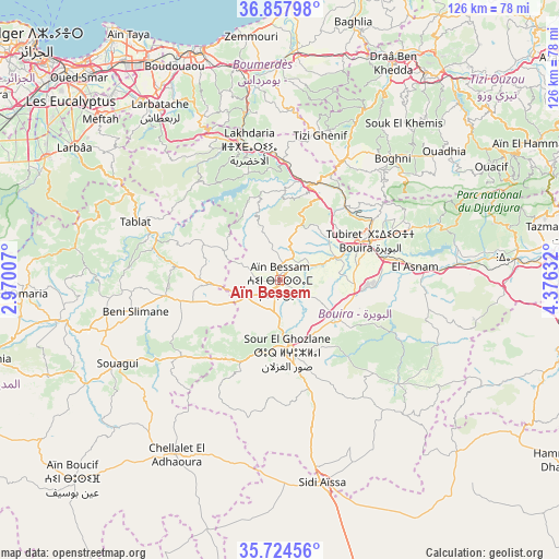
Aïn Bessem GPS coordinates[2]
36° 17' 35.988" North, 3° 40' 23.484" East
| Map corner | latitude | longitude |
|---|---|---|
| Upper-left | 36.85798°, | 2.97007° |
| Center: | 36.29333°, | 3.67319° |
| Lower-right: | 35.72456°, | 4.37632° |
| Map W x H: | 126×126 km | = 78.3×78.3mi |
| max Lat: | 36.92917° ⇑39.5% North |
| Aïn Bessem: | 36.29333° |
| min Lat: | ⇓60.5% South 22.785° |
| min Long | Aïn Bessem | max Long |
| -8.14743° | 3.67319° | 8.46667° |
| W 51.9%⇐ | ⇒48.1% E |
Elevation
Elevation of Aïn Bessem is 677 m = 2221 ft, and this is 238.5 m = 782 ft above average elevation for this country.
| Max E: |
1392 m = 4567 ft | 29.8% |
| Aïn Bessem | 677 m 2221 ft | |
| Avg. | 438.5 m = 1439 ft | |
Min E: |
5 m = 16 ft | 70.2% |
See also: Algeria elevation on elevation.city.
Geographical zone
Aïn Bessem is located in North temperate zone (between Tropic of Cancer and the Arctic Circle). Distance of this Northern Tropic circle is 1429.5 km =888.2 mi to South.| Distance of | km | miles | from Aïn Bessem |
|---|---|---|---|
| North Pole | 5971.6 | 3710.6 | to North |
| Arctic Circle | 3365.7 | 2091.3 | to North |
| Tropic Cancer | 1429.5 | 888.2 | to South |
| Equator | 4035.4 | 2507.5 | to South |


Nearby cities:
15 places around Aïn Bessem: (largest is in red/bold)
• Arbatache
46.9 km =29.1 mi,  324°
324°
• Beni Amrane
42.3 km =26.3 mi,  350°
350°
• Boghni
37.3 km =23.2 mi,  42°
42°
• Bouïra
22.4 km =13.9 mi,  66°
66°
• Chabet el Ameur
38.3 km =23.8 mi,  2°
2°
• Draa el Mizan
30.6 km =19 mi,  27°
27°
• Khemis el Khechna
50.1 km =31.1 mi, 322°
• Lakhdaria
31 km =19.3 mi, 346°
• Ouled Moussa
51.4 km =31.9 mi,  327°
327°
• Sidi Aïssa
46.2 km =28.7 mi,  168°
168°
• Sour el Ghozlane
16.3 km =10.1 mi, 174°
• Thenia
49.2 km =30.6 mi, 347°
• Tirmitine
48.7 km =30.3 mi, 34°
• Tizi Gheniff
34 km =21.1 mi,  15°
15°
• Tizi-n-Tleta
44.4 km =27.6 mi,  50°
50°
Sources, notices
• [Note1] Compared only with cities in Algeria existing in our database
• [Src1] Map data: © OpenStreetMap contributors (CC-BY-SA)
• [Src2] Other city data from geonames.org with taken over terms of usage.
• [Src3] Geographical zone / Annual Mean Temperature by Robert A. Rohde @ Wikipedia
