Santa Elena geodata
Santa Elena is a seat of a first-order administrative division; located in Ecuador in America/Guayaquil (GMT-5) time zone. With population of 42,214 people, there are 26 cities with bigger population in this country. Compared to other cities in Ecuador, 73.6% of cities are located further ↑North; 95.9% of cities are located further →East and 64.5% of cities have higher elevation than Santa Elena. Note1


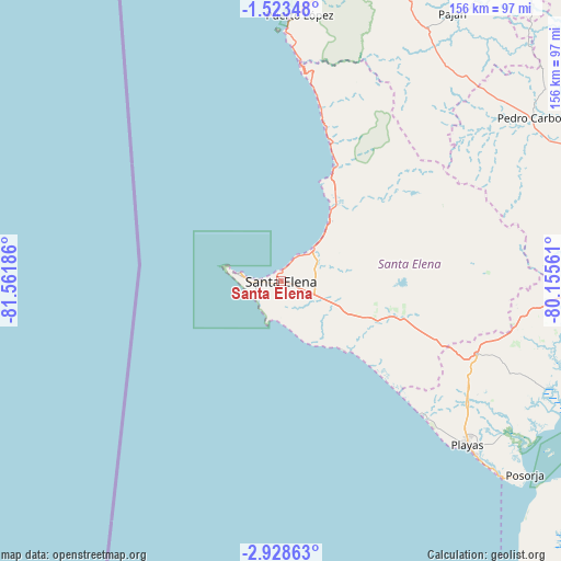
Santa Elena GPS coordinates[2]
2° 13' 34.392" South, 80° 51' 31.428" West
| Map corner | latitude | longitude |
|---|---|---|
| Upper-left | -1.52348°, | -81.56186° |
| Center: | -2.22622°, | -80.85873° |
| Lower-right: | -2.92863°, | -80.15561° |
| Map W x H: | 156.2×156.2 km | = 97.1×97.1mi |
| max Lat: | 1.35251° ⇑73.6% North |
| Santa Elena: | -2.22622° |
| min Lat: | ⇓26.4% South -4.38181° |
| min Long | Santa Elena | max Long |
| -90.96654° | -80.85873° | -76.89528° |
| W 4.1%⇐ | ⇒95.9% E |
Elevation
Elevation of Santa Elena is 43 m = 141 ft, and this is 902.1 m = 2960 ft below average elevation for this country.
| Max E: |
3131 m = 10272 ft | 64.5% |
| Avg. | 945.1 m = 3101 ft | |
| Santa Elena | 43 m = 141 ft | |
Min E: |
1 m = 3 ft | 35.5% |
See also: Santa Elena elevation on elevation.city.
Geographical zone
Santa Elena is located in South Torrid zone (between Equator and Tropic of Capricorn). Distance of Equator is 247.5 km =153.8 mi to North.| Distance of | km | miles | from Santa Elena |
|---|---|---|---|
| Equator | 247.5 | 153.8 | to North |
| Tropic Capricorn | 2358.4 | 1465.4 | to South |
| Antarctic Circle | 7153.6 | 4445 | to South |
| South Pole | 9759.5 | 6064.3 | to South |


Nearby cities:
15 places around Santa Elena: (largest is in red/bold)
• Colimes
120.8 km =75.1 mi,  51°
51°
• El Triunfo
104.3 km =64.8 mi,  71°
71°
• Eloy Alfaro
111.6 km =69.3 mi,  87°
87°
• Guayaquil
108.1 km =67.2 mi, 88°
• Jipijapa
102.4 km =63.6 mi,  17°
17°
• La Libertad
5.8 km =3.6 mi,  262°
262°
• Lomas de Sargentillo
94.2 km =58.5 mi, 66°
• Paján
88.8 km =55.2 mi,  32°
32°
• Pedro Carbo
83.2 km =51.7 mi,  56°
56°
• Playas
69.1 km =42.9 mi,  130°
130°
• Salinas
10.4 km =6.5 mi,  277°
277°
• Samborondón
129.4 km =80.4 mi,  76°
76°
• Santa Ana
125.6 km =78 mi, 25°
• Santa Lucía
95.5 km =59.3 mi, 87°
• Sucre
116 km =72.1 mi, 24°
Sources, notices
• [Note1] Compared only with cities in Ecuador existing in our database
• [Src1] Map data: © OpenStreetMap contributors (CC-BY-SA)
• [Src2] Other city data from geonames.org with taken over terms of usage.
• [Src3] Geographical zone / Annual Mean Temperature by Robert A. Rohde @ Wikipedia
