Colimes geodata
Colimes (Guayas) is a populated place; located in Ecuador in America/Guayaquil (GMT-5) time zone. With population of 9,384 people, there are 87 cities with bigger population in this country. Compared to other cities in Ecuador, 51.2% of cities are located further ↑North; 78.5% of cities are located further →East and 71.9% of cities have higher elevation than Colimes. Note1


Colimes GPS coordinates[2]
1° 32' 43.908" South, 80° 0' 41.94" West
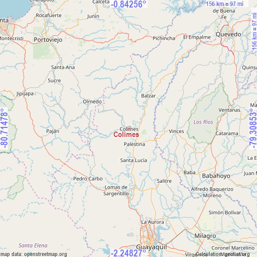
| Map corner | latitude | longitude |
|---|---|---|
| Upper-left | -0.84256°, | -80.71478° |
| Center: | -1.54553°, | -80.01165° |
| Lower-right: | -2.24827°, | -79.30853° |
| Map W x H: | 156.3×156.3 km | = 97.1×97.1mi |
| max Lat: | 1.35251° ⇑51.2% North |
| Colimes: | -1.54553° |
| min Lat: | ⇓48.8% South -4.38181° |
| min Long | Colimes | max Long |
| -90.96654° | -80.01165° | -76.89528° |
| W 21.5%⇐ | ⇒78.5% E |
Elevation
Elevation of Colimes is 25 m = 82 ft, and this is 920.1 m = 3019 ft below average elevation for this country.
| Max E: |
3131 m = 10272 ft | 71.9% |
| Avg. | 945.1 m = 3101 ft | |
| Colimes | 25 m = 82 ft | |
Min E: |
1 m = 3 ft | 28.1% |
See also: Ecuador elevation on elevation.city.
Geographical zone
Colimes is located in South Torrid zone (between Equator and Tropic of Capricorn). Distance of Equator is 171.8 km =106.8 mi to North.| Distance of | km | miles | from Colimes |
|---|---|---|---|
| Equator | 171.8 | 106.8 | to North |
| Tropic Capricorn | 2434.1 | 1512.5 | to South |
| Antarctic Circle | 7229.3 | 4492.1 | to South |
| South Pole | 9835.2 | 6111.3 | to South |


Nearby cities:
15 places around Colimes: (largest is in red/bold)
• Babahoyo
60.2 km =37.4 mi,  118°
118°
• Balzar
23.3 km =14.5 mi,  30°
30°
• Catarama
61.4 km =38.2 mi,  93°
93°
• El Triunfo
43.4 km =27 mi,  173°
173°
• Jipijapa
66.7 km =41.4 mi,  289°
289°
• Lomas de Sargentillo
38.4 km =23.9 mi,  191°
191°
• Paján
46.5 km =28.9 mi,  269°
269°
• Palenque
30.8 km =19.1 mi,  67°
67°
• Palestina
54.7 km =34 mi,  142°
142°
• Pedro Carbo
38.8 km =24.1 mi,  219°
219°
• Samborondón
56.3 km =35 mi,  145°
145°
• Santa Ana
54.9 km =34.1 mi,  313°
313°
• Sucre
54.1 km =33.6 mi,  303°
303°
• Ventanas
62.5 km =38.8 mi,  79°
79°
• Vinces
28.9 km =18 mi, 92°
Sources, notices
• [Note1] Compared only with cities in Ecuador existing in our database
• [Src1] Map data: © OpenStreetMap contributors (CC-BY-SA)
• [Src2] Other city data from geonames.org with taken over terms of usage.
• [Src3] Geographical zone / Annual Mean Temperature by Robert A. Rohde @ Wikipedia
