Alfredo Baquerizo Moreno geodata
Alfredo Baquerizo Moreno (Guayas) is a populated place; located in Ecuador in America/Guayaquil (GMT-5) time zone. With population of 12,617 people, there are 73 cities with bigger population in this country. Compared to other cities in Ecuador, 62% of cities are located further ↑North; 53.7% of cities are located further →East and 90.9% of cities have higher elevation than Alfredo Baquerizo Moreno. Note1
Administrative division(s):
- Level 1: Guayas
- Level 2: Alfredo Baquerizo Moreno (Juján)
- Level 3: Alfredo Baquerizo Moreno (Jujan)
Current local time in Alfredo Baquerizo Moreno:
04:15 AM, SaturdayDifference from your time zone: hours


Alfredo Baquerizo Moreno GPS coordinates[2]
1° 55' 0.012" South, 79° 31' 0.012" West
| Map corner | latitude | longitude |
|---|---|---|
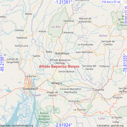
| Upper-left | -1.21381°, | -80.2198° |
| Center: | -1.91667°, | -79.51667° |
| Lower-right: | -2.61924°, | -78.81355° |
| Map W x H: | 156.3×156.3 km | = 97.1×97.1mi |
| max Lat: | 1.35251° ⇑62% North |
| Alfredo Baquerizo Moreno: | -1.91667° |
| min Lat: | ⇓38% South -4.38181° |
| min Long | Alfredo Baqueri | max Long |
| -90.96654° | -79.51667° | -76.89528° |
| W 46.3%⇐ | ⇒53.7% E |
Elevation
Elevation of Alfredo Baquerizo Moreno is 9 m = 30 ft, and this is 936.1 m = 3071 ft below average elevation for this country.
| Max E: |
3131 m = 10272 ft | 90.9% |
| Avg. | 945.1 m = 3101 ft | |
| Alfredo Baquerizo Moreno | 9 m = 30 ft | |
Min E: |
1 m = 3 ft | 9.1% |
See also: Ecuador elevation on elevation.city.
Geographical zone
Alfredo Baquerizo Moreno is located in South Torrid zone (between Equator and Tropic of Capricorn). Distance of Equator is 213.1 km =132.4 mi to North.| Distance of | km | miles | from Alfredo Baquerizo Moreno |
|---|---|---|---|
| Equator | 213.1 | 132.4 | to North |
| Tropic Capricorn | 2392.8 | 1486.8 | to South |
| Antarctic Circle | 7188.1 | 4466.5 | to South |
| South Pole | 9793.9 | 6085.6 | to South |


Nearby cities:
15 places around Alfredo Baquerizo Moreno: (largest is in red/bold)
• Babahoyo
12.9 km =8 mi,  351°
351°
• Catarama
38.5 km =23.9 mi,  9°
9°
• Coronel Marcelino Maridueña
33.8 km =21 mi,  163°
163°
• El Triunfo
50 km =31.1 mi,  267°
267°
• Eloy Alfaro
47.4 km =29.5 mi,  232°
232°
• Guayaquil
51.5 km =32 mi, 232°
• Milagro
25.7 km =16 mi,  199°
199°
• Montalvo
29.1 km =18.1 mi,  61°
61°
• Naranjito
28.4 km =17.6 mi,  168°
168°
• Palestina
22 km =13.7 mi,  264°
264°
• Samborondón
23.6 km =14.7 mi, 257°
• San Miguel
57.5 km =35.7 mi,  66°
66°
• Ventanas
53.2 km =33.1 mi, 6°
• Vinces
47.9 km =29.8 mi,  326°
326°
• Yaguachi Nuevo
28.2 km =17.5 mi,  224°
224°
Sources, notices
• [Note1] Compared only with cities in Ecuador existing in our database
• [Src1] Map data: © OpenStreetMap contributors (CC-BY-SA)
• [Src2] Other city data from geonames.org with taken over terms of usage.
• [Src3] Geographical zone / Annual Mean Temperature by Robert A. Rohde @ Wikipedia
