Palivere geodata
Palivere (Lääne) is a populated place; located in Estonia in Europe/Tallinn (GMT+3) time zone. With population of 968 people, there are 96 cities with bigger population in this country. Compared to other cities in Estonia, 55.3% of cities are located further ↓South; 90.5% of cities are located further →East and 58.9% of cities have lower elevation than Palivere. Note1


Palivere GPS coordinates[2]
58° 58' 13.008" North, 23° 54' 11.988" East
| Map corner | latitude | longitude |
|---|---|---|
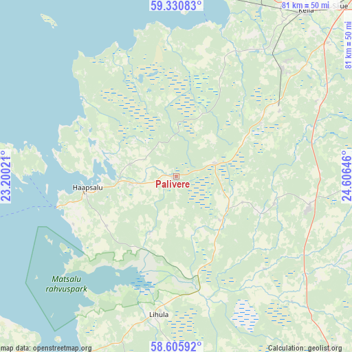
| Upper-left | 59.33083°, | 23.20021° |
| Center: | 58.97028°, | 23.90333° |
| Lower-right: | 58.60592°, | 24.60646° |
| Map W x H: | 80.6×80.6 km | = 50.1×50.1mi |
| max Lat: | 59.57639° ⇑44.7% North |
| Palivere: | 58.97028° |
| min Lat: | ⇓55.3% South 57.72778° |
| min Long | Palivere | max Long |
| 22.24646° | 23.90333° | 28.19028° |
| W 9.5%⇐ | ⇒90.5% E |
Elevation
Elevation of Palivere is 60 m = 197 ft, and this is 6.8 m = 22 ft above average elevation for this country.
| Max E: |
141 m = 463 ft | 41.1% |
| Palivere | 60 m 197 ft | |
| Avg. | 53.2 m = 175 ft | |
Min E: |
6 m = 20 ft | 58.9% |
See also: Estonia elevation on elevation.city.
Geographical zone
Palivere is located in North temperate zone (between Tropic of Cancer and the Arctic Circle). Distance of this North polar circle is 844.3 km =524.6 mi to North.| Distance of | km | miles | from Palivere |
|---|---|---|---|
| North Pole | 3450.2 | 2143.9 | to North |
| Arctic Circle | 844.3 | 524.6 | to North |
| Tropic Cancer | 3951 | 2455 | to South |
| Equator | 6556.9 | 4074.3 | to South |


Nearby cities:
15 places around Palivere: (largest is in red/bold)
• Haapsalu
21 km =13 mi,  261°
261°
• Harku
32.3 km =20.1 mi,  56°
56°
• Hullo
37.8 km =23.5 mi,  273°
273°
• Klooga
42.6 km =26.5 mi,  24°
24°
• Lehola
42.7 km =26.5 mi,  33°
33°
• Lihula
32.3 km =20.1 mi,  185°
185°
• Märjamaa
31.1 km =19.3 mi,  103°
103°
• Orgita
30.5 km =19 mi, 98°
• Paldiski
43.8 km =27.2 mi,  11°
11°
• Riisipere
28.3 km =17.6 mi, 55°
• Taebla
8.9 km =5.5 mi, 258°
• Turba
22.3 km =13.9 mi, 55°
• Uuemõisa
18.3 km =11.4 mi, 259°
• Vana-Vigala
30.8 km =19.1 mi,  136°
136°
• Vasalemma
37.6 km =23.4 mi,  35°
35°
Sources, notices
• [Note1] Compared only with cities in Estonia existing in our database
• [Src1] Map data: © OpenStreetMap contributors (CC-BY-SA)
• [Src2] Other city data from geonames.org with taken over terms of usage.
• [Src3] Geographical zone / Annual Mean Temperature by Robert A. Rohde @ Wikipedia
