Lihula geodata
Lihula (Pärnumaa) is a seat of a second-order administrative division; located in Estonia in Europe/Tallinn (GMT+3) time zone. With population of 1,457 people, there are 64 cities with bigger population in this country. Compared to other cities in Estonia, 57.4% of cities are located further ↑North; 91.1% of cities are located further →East and 84.7% of cities have higher elevation than Lihula. Note1


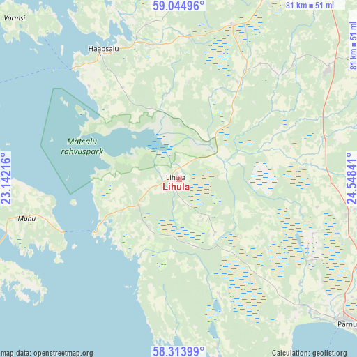
Lihula GPS coordinates[2]
58° 40' 53.004" North, 23° 50' 43.008" East
| Map corner | latitude | longitude |
|---|---|---|
| Upper-left | 59.04496°, | 23.14216° |
| Center: | 58.68139°, | 23.84528° |
| Lower-right: | 58.31399°, | 24.54841° |
| Map W x H: | 81.3×81.3 km | = 50.5×50.5mi |
| max Lat: | 59.57639° ⇑57.4% North |
| Lihula: | 58.68139° |
| min Lat: | ⇓42.6% South 57.72778° |
| min Long | Lihula | max Long |
| 22.24646° | 23.84528° | 28.19028° |
| W 8.9%⇐ | ⇒91.1% E |
Elevation
Elevation of Lihula is 19 m = 62 ft, and this is 34.2 m = 112 ft below average elevation for this country.
| Max E: |
141 m = 463 ft | 84.7% |
| Avg. | 53.2 m = 175 ft | |
| Lihula | 19 m = 62 ft | |
Min E: |
6 m = 20 ft | 15.3% |
See also: Estonia elevation on elevation.city.
Geographical zone
Lihula is located in North temperate zone (between Tropic of Cancer and the Arctic Circle). Distance of this North polar circle is 876.4 km =544.6 mi to North.| Distance of | km | miles | from Lihula |
|---|---|---|---|
| North Pole | 3482.3 | 2163.8 | to North |
| Arctic Circle | 876.4 | 544.6 | to North |
| Tropic Cancer | 3918.8 | 2435 | to South |
| Equator | 6524.8 | 4054.3 | to South |


Nearby cities:
15 places around Lihula: (largest is in red/bold)
• Audru
43.1 km =26.8 mi,  134°
134°
• Haapsalu
34 km =21.1 mi,  328°
328°
• Lavassaare
36.7 km =22.8 mi,  120°
120°
• Liiva
35.7 km =22.2 mi,  255°
255°
• Märjamaa
41.8 km =26 mi,  53°
53°
• Orgita
43.4 km =27 mi, 50°
• Palivere
32.3 km =20.1 mi,  5°
5°
• Pärnu-Jaagupi
39.1 km =24.3 mi,  101°
101°
• Risti
13.4 km =8.3 mi,  181°
181°
• Taebla
30.8 km =19.1 mi,  349°
349°
• Tõstamaa
39.8 km =24.7 mi,  166°
166°
• Uuemõisa
32.3 km =20.1 mi, 332°
• Vana-Vigala
26.6 km =16.5 mi,  68°
68°
• Virtsu
22.4 km =13.9 mi,  236°
236°
• Võiste
44 km =27.3 mi, 122°
Sources, notices
• [Note1] Compared only with cities in Estonia existing in our database
• [Src1] Map data: © OpenStreetMap contributors (CC-BY-SA)
• [Src2] Other city data from geonames.org with taken over terms of usage.
• [Src3] Geographical zone / Annual Mean Temperature by Robert A. Rohde @ Wikipedia
